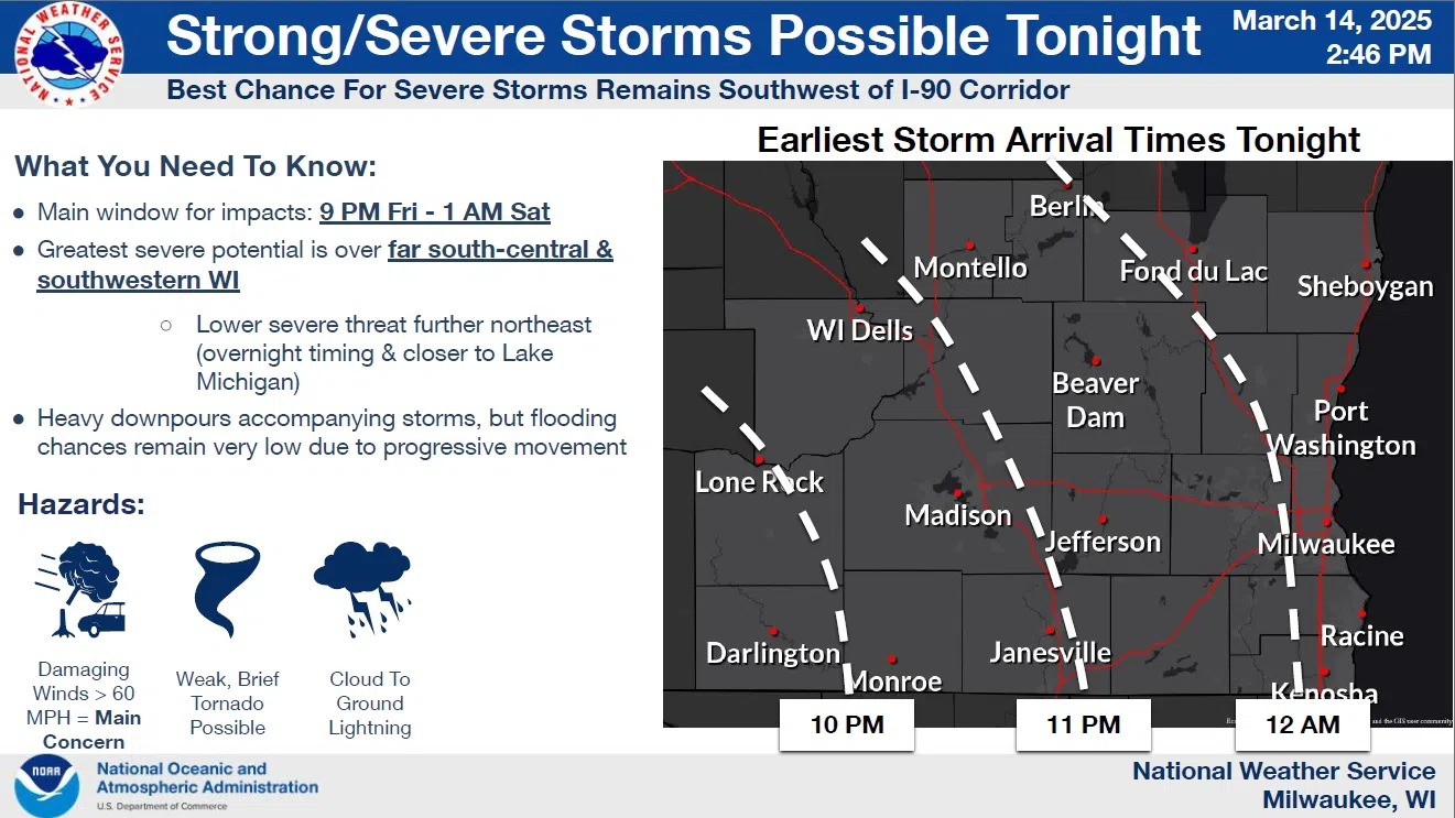
As weather systems usually do, an approaching spring storm has been developing slightly differently than forecasters had expected, moving the timeline for potential thunderstorms further into the nighttime. For the Sheboygan area, that means our prime-time will be after midnight, with the resulting effect of lowering the severe potential in the absence of daytime energy. Forecasters still advise keeping alerts activated on cellphones and other devices as some storms could produce straight line winds of over 60 mph, as well as cloud-to-ground lightning.
NWS Graphic
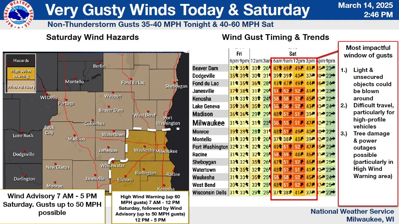
Following any storms, winds will shift to the north and strengthen to warning levels in much of the state. While we do have an “Advisory” in effect between 7 a.m and 5 p.m. Saturday, which includes the chance for gusts over 50 mph between 9 a.m. and 3 p.m., that is still somewhat more “gentle” than the 55-60 mph blasts expected in counties from Waukesha and Milwaukee southward where a High Wind Warning has been issued for the hours of 7 a.m. – 12 p.m.
For the rest of the weekend, temperatures decline from tomorrow’s mid-50s to highs near 40 on Sunday, but then rebound nicely to a still-warmer-than-usual 50 on Monday.


Comments