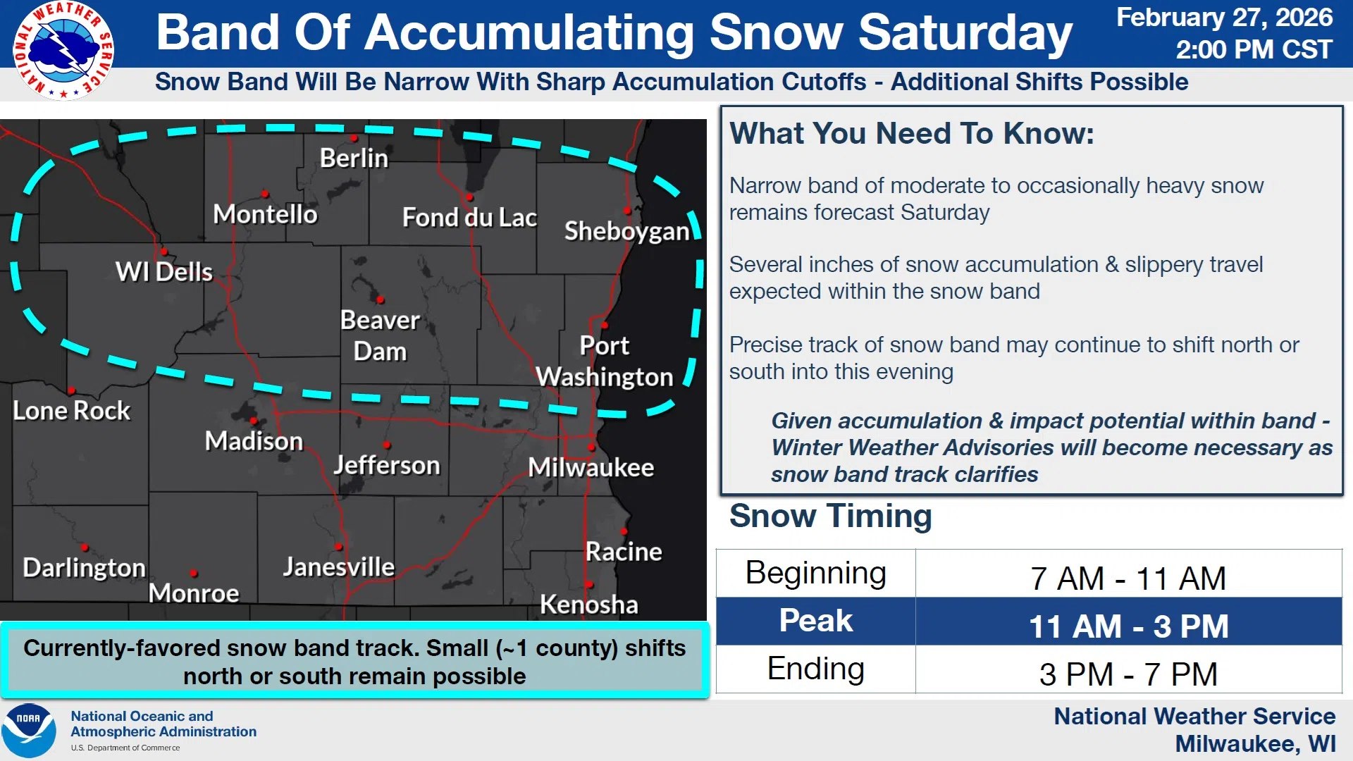
As forecast models become more certain, the National Weather Service will consider issuing Winter Weather Advisories for Saturday. If, where, and when will all become clearer tonight as the system progresses.
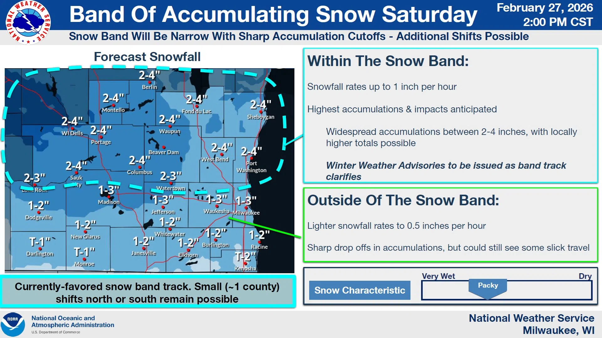
As-is, Sheboygan County is within the area that could see snow beginning between 7 and 11 AM Saturday, peaking between 11 AM and 3 PM, and moving east out of the region between 3 and 7 PM. If the most intense snow band does set up in Sheboygan County, the affected area could experience accumulation rates of up to 1 inch per hour of “packy” snow, widespread accumulations between 2 and 4 inches, with locally higher totals possible. This will result in reduced visibilities and slippery travel.
NWS Graphic
Given those possibilities, the National Weather Service said that issuance of Winter Weather Advisories should be monitored tonight.
Following the snow, clearing and cold conditions are expected overnight Saturday, with Sunday featuring partly sunny skies and highs in the mid 20s.


Comments