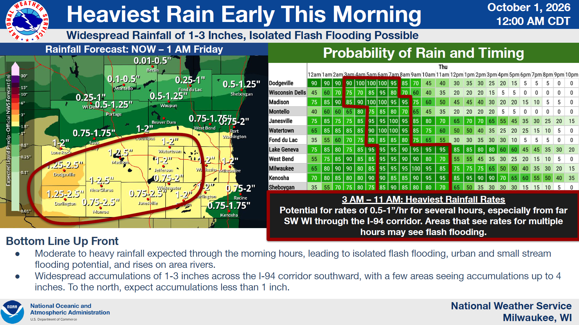
An area of moisture fueled by tropical systems is wringing itself out over Wisconsin and much of the Midwest this morning, and the National Weather Service has been keeping a close watch. That’s because some areas could receive flooding rain up to 4 inches that could pond on roadways and cause streams and rivers to rises.
As of now, those conditions should be across and south of the I-94 corridor, especially in southwest Wisconsin.
For the Sheboygan area, an inch or more could fall between now and late this afternoon, when rain should wind down. After gradual clearing overnight we should be set up for a mostly sunny, dry weekend, with cool highs in the 60s and chilly lows in the 40s well into next week.




Comments