“April Showers Bring May Flowers”…so the phrase goes, but rain forecast for later today will only add to an already soggy month, whether or not the flowers benefit. Fortunately, any severe weather potential looks to be situated to our south.
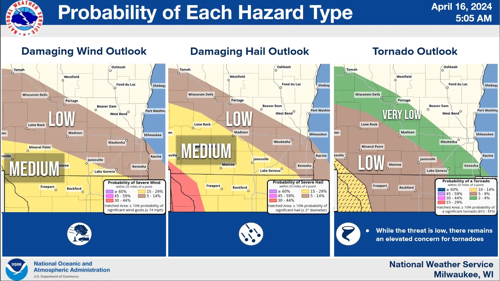
The National Weather Service has been watching today’s severe potential since last week, but now forecasters say that areas along and west-southwest of I-90 are most likely to receive hail larger than an inch, damaging winds, and maybe a few tornadoes, with most of the action between 5 and 9 p.m.. While severe storms can’t be entirely ruled out here, smaller hail and lighter gusty winds are more likely, and heavy rain could still cause a few problems.
The Sheboygan County Airport has already recorded an inch-and-three-quarters of rainfall this month with most of that falling on the 2nd. Normal for this point in April is 1.49 inches. Soil remains soggy, and with up to another inch expected in the next day or two, gardeners and farmers will have to hope for another dry stretch to follow in order for work to resume.
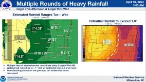
Rain will Keep Soil Soggy. NWS Graphic


Comments