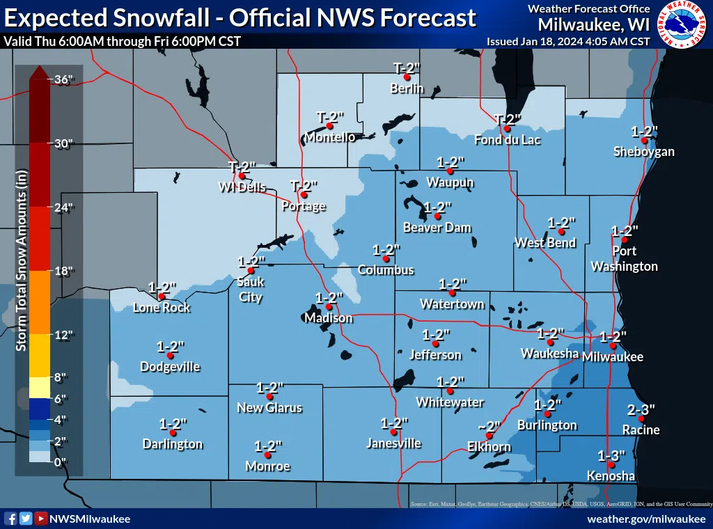
A brief reprieve from the coldest weather of the season so far is being followed by another round of snow. The very southeast corner of the state stands the best chance of hitting the 3-inch mark from snows that likely begin during the evening hours. Around here there could be an inch or two of light, fluffy snow, with the outside chance of a little extra right along the lakeshore. That narrow band east of I-43 could see a 2 or 3-inch fall depending on Lake Michigan’s contributions, with the majority of that falling before sunup on Friday.
Wednesday’s relative warmup and sun was enough to give many crews the opportunity to clear at least some the glacier-like pack of snow and ice that was hardened by traffic and the below-zero weather. However many roads remain slick, and any new snow would add an extra measure of slippery uncertainty for drivers, especially by tomorrow morning’s commute. Forecasters advise caution throughout Friday, though, as brisk northwest winds may keep the newly-fallen snow on the move for some time, blowing back onto, and drifting on some area roadways, especially near the lake.


Comments