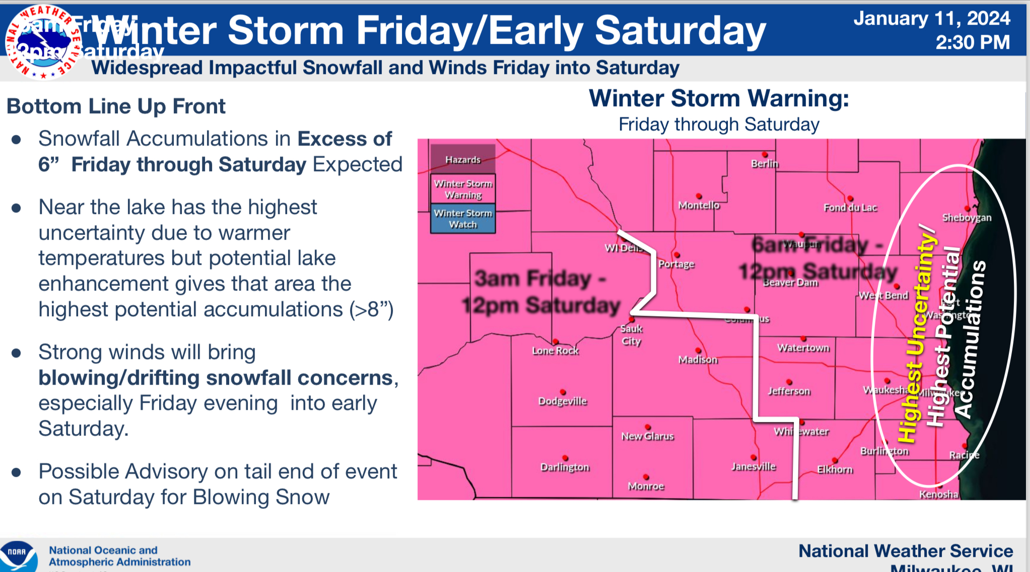
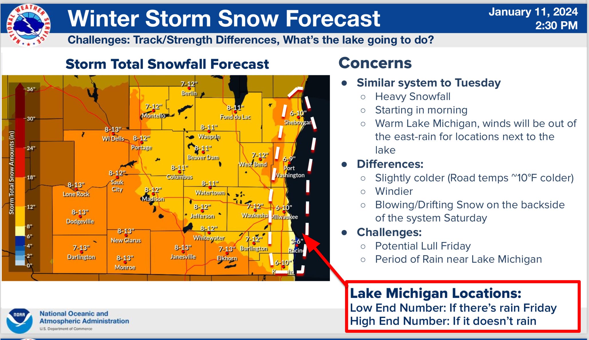
The latest information from the National Weather Service in Milwaukee suggests that the next winter storm, forecast to begin in the early hours of Friday, could eventually deposit somewhere between six and ten inches of snow in Sheboygan County. With accompaniment by high winds and dropping temperatures, the National Weather Service has now issued a Winter Storm Warning in effect from 6 a.m. Friday until noon on Saturday for Sheboygan, Ozaukee, Milwaukee, Racine and Kenosha Counties. The highest probability of more than eight inches of snow is oriented north-to-south, centered basically about 15-20 miles inland of Michigan from the north-central extreme of Sheboygan County in the north, southward to the Milwaukee County line along the Washington/Ozaukee County line in the south. That area is far enough inland of Lake Michigan to maintain the colder temperatures needed for producing all snow, along with a close enough proximity to experience increased moisture from the relatively warm waters, which are currently around 36 degrees off the Sheboygan shoreline.
Light snow should begin by 4 a.m. on Friday, becoming heavier by daybreak, and eventually reaching accumulations of a half inch per hour from noon until midnight. Snow should begin to ease by noon on Saturday, by that time exhausting most available moisture. However, winds will be a major factor, with sustained winds of around 20 mph for most of Friday, and gusts increasing to more than 40 mph by 10 p.m. And with a shift from off the lake, to northwesterly, temperatures will fall to near 20 degrees on Saturday morning, and continue falling to near zero by sunup on Sunday. After that, overnight lows look to arrive near 5 below or colder each day, as highs struggling to clear positive territory until Wednesday. Forecasters add that Windchill Advisories are likely to be issued for levels that, for Sheboygan County, are forecast to reach as low as -28 degrees on Tuesday morning.
Of course, as with any winter storm, forecasts are probably wrong in some aspects and to some degree. A favorable shift could keep temperatures warmer and snow production down, while colder temperatures could enhance snow totals, especially near the lake.
What appears certain, for now, is that a dangerous storm is approaching and should be taken seriously. This kind of storm has the potential to down power lines and block roadways for substantial amounts of time. Whether or not that potential is realized will become clearer with upcoming forecasts.




Comments