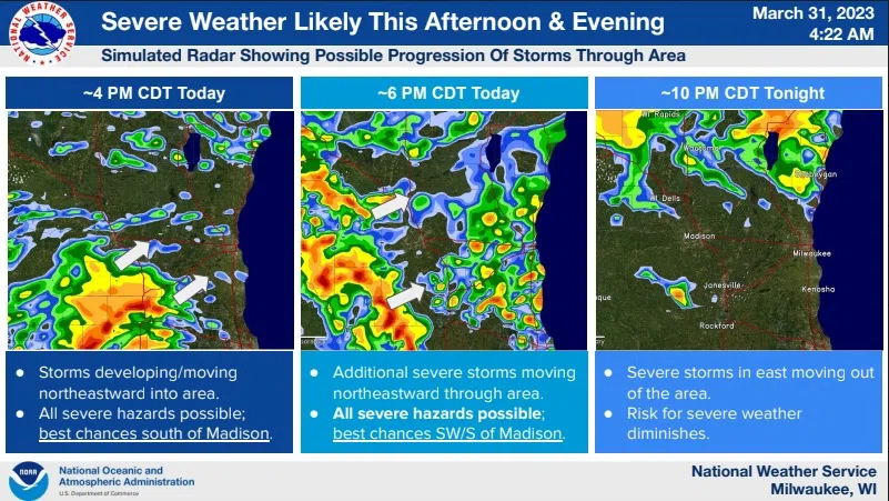
Spring rains on top of recent snow melt can carry a risk of flooding, but that risk appears low today according to National Weather Service forecasters. A slight risk of severe thunderstorms was assigned for about the southern quarter of Sheboygan County today with the remainder at a marginal risk, with the main concern here being the high winds that storms can produce. There’s a small risk of damaging hail here, while the chance for tornadoes is mostly limited to south-central and southwest Wisconsin.
Heavy rains also carry a flood risk, and with saturated soils from recent snow melt much of that inch or so of expected rainwater will likely run off into rivers and streams. For the Sheboygan River, forecasters say waters could briefly reach “action” level by midday Saturday, causing minor lowland flooding and possibly submerging marina docks and piers in Sheboygan. Waters should subside below action level by Monday.

Flood Potential for the Sheboygan River Now Through April 6


Comments