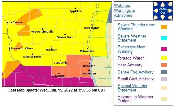
Hot, humid weather began settling in over most of Wisconsin beginning Tuesday, and by Wednesday afternoon even the usually cooler-than-most Sheboygan County was sweltering along. At 3 p.m. the National Weather Service reported a temperature of 90 at the Sheboygan County Airport, and with a dew point of 75 – something akin to that of the Amazon – the heat index had reached 100 degrees.
A heat advisory was in effect until 8 p.m. for much of southeastern Wisconsin including Sheboygan County, and by 2:30 p.m. with a vigorous weather system approaching the National Weather Service had added a tornado watch until 10 p.m.
Because of the thunderstorms expected across Lake Michigan, at 3:45 p.m. the U.S. Coast Guard issued a rare warning to the public advising of possible water spouts, hail up to 1” or larger, and damaging winds above 50 knots as the storms move east towards Michigan. Captain Donald Montoro, commander of Sector Lake Michigan advised that “We urge all mariners to exercise extreme caution and prudence throughout the duration of this storm. Only go out on the water if absolutely necessary. Always wear your life jacket, ensure you have a working marine radio tuned to channel 16, and that you tell a family member or friend where and when you will be on the water.”
The USCG said that should storms develop as expected, they would have the potential to damage vessels, piers, mooring areas, and coastal facilities.


Comments