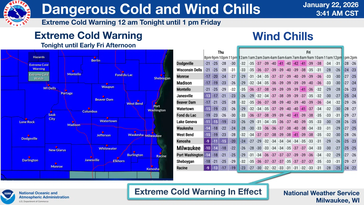
Brutal winter weather is on our doorstep, generating National Weather Service warnings and prompting many area schools to cancel Friday classes, including the Sheboygan Area School District.
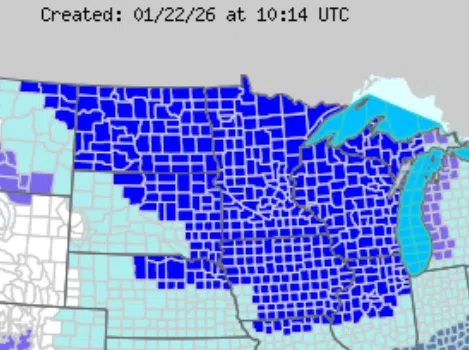
This National Weather Service Map Shows Huge Area Under Extreme Cold Warnings
The big slide begins after the sun fades this evening and northwest winds funnel polar air into the region. Once actual temperatures slip below zero late tonight, they’re not forecast to get above that mark again until noon on Saturday.
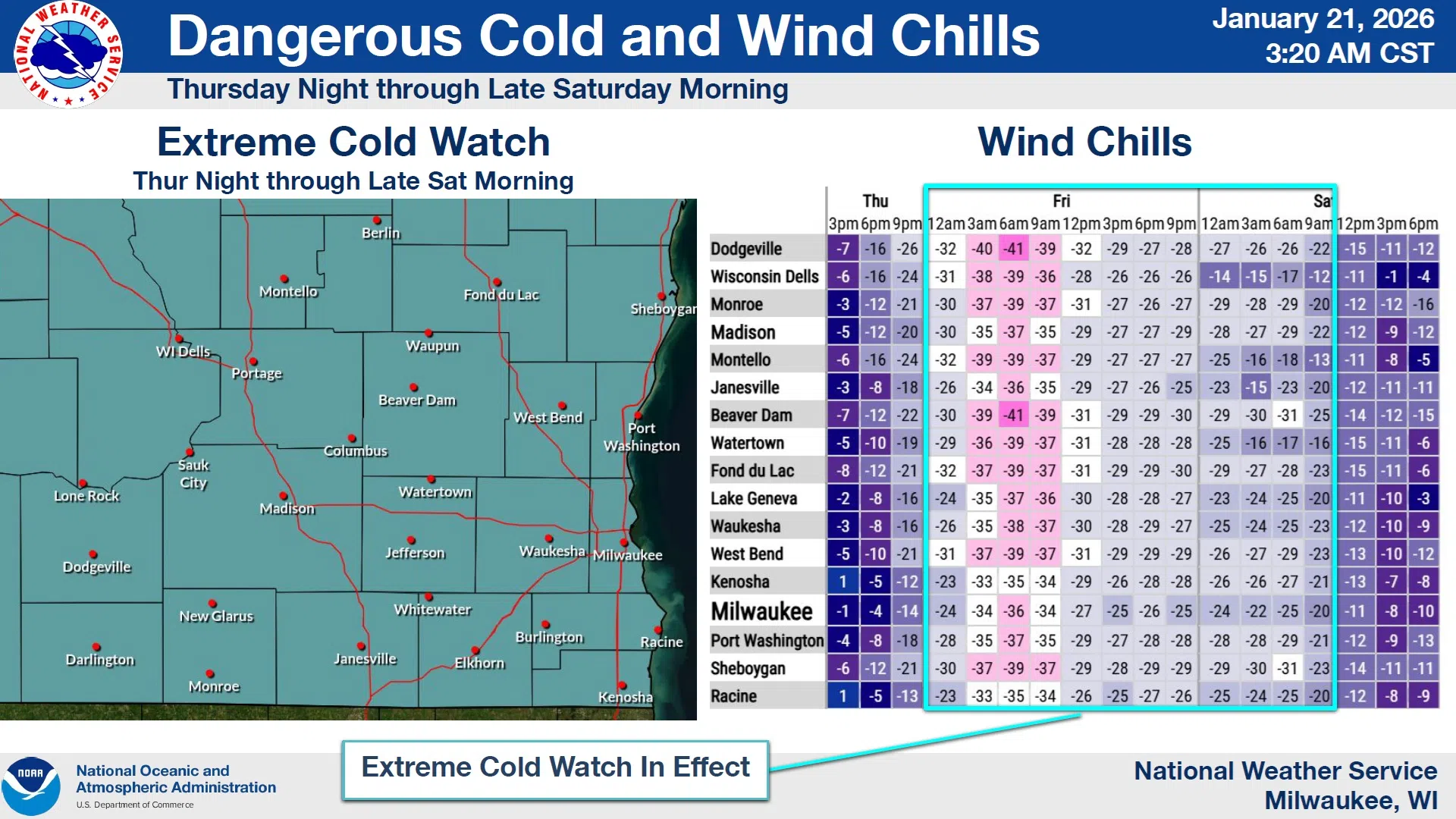
While arctic temperatures are present, so will be the winds, driving wind chill factors to a dangerous 40° below zero at times on gusts over 30 MPH until around 1 PM tomorrow. Accordingly, an Extreme Cold Warning covers the hours from midnight tonight until noon tomorrow. And with uncertainty over the intensity of the cold the rest of tomorrow, an Extreme Cold Watch follows that from 1 PM Friday until noon Saturday.
NWS Graphic
Outdoor time should be limited for both people and pets, and then only with proper layers and protection, as exposed skin can become frostbitten in under 10 minutes under those conditions.


Comments