
With the next weather system now on our doorstep, the National Weather Service has increasing confidence over what’s in store for Wisconsin and Sheboygan County.

NWS Graphic
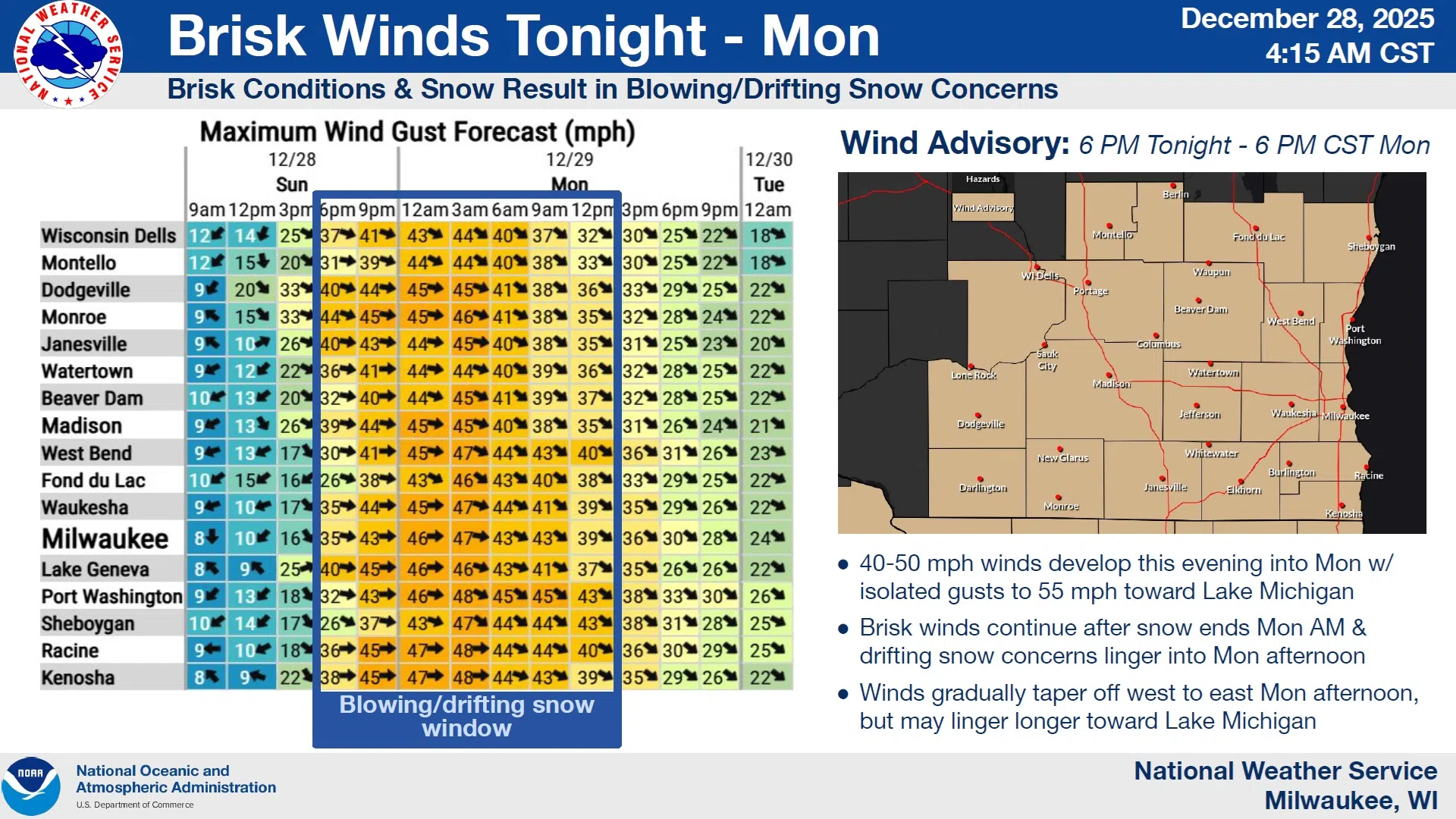
Snow accumulations between 2 and 5 inches accompanied by high winds and falling temperatures will cause difficult travel conditions overnight, lasting into Monday. A Wind Advisory was issued for the 24 hour period from 6 this evening until 6 PM Monday, while the snow and falling temperatures have prompted a Winter Weather Advisory from 6 tonight until noon on Monday.
NWS Graphic
The lowest snow totals should affect southeastern portions of Sheboygan County with the higher amounts to the northwest. Winds will reach the highest velocity near Lake Michigan where gusts could reach, and even exceed 50 MPH by 5 AM Monday, threatening any unanchored objects with involuntary relocation, and keeping snow on the move and roads slick. Such winds are also capable of breaking tree branches which can cause power outages.

NWS Graphic
A short distance to our north, Manitowoc County can expect anywhere from 3 to 7 inches of snow on only slightly lighter winds and a Winter Storm Warning was issued. On the other end of the spectrum those south of Ozaukee County snow will be scant, but winds and falling temperatures will still dominate. No storm advisories affect far southeastern Wisconsin.
Mariners on Lake Michigan have their own Storm Warning from 7 tonight all the way through 6 AM Tuesday as winds gusting up to 50 knots will generate waves of 17-22 feet, capable of damaging or capsizing even large vessels.
Looking ahead to New Year’s Eve, only a 20% chance of snow is forecast after noon with highs reaching near 25 degrees. By midnight temperatures should hold near 10 above, but it will likely feel more like 5 below zero.


Comments