
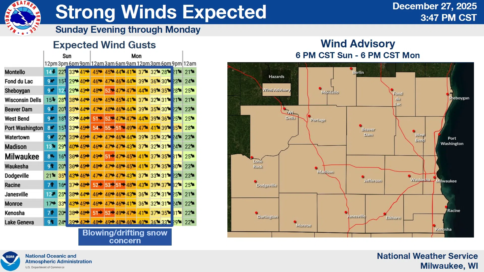
Weather factors that may impact your activities over the next few days have prompted the National Weather Service to issue a variety of warnings for Wisconsin. Concern centers around the combination of snowfall, winds, and falling temperatures. Forecasters say the results will be slippery road conditions, greatly reduced visibility in blowing snow – especially during the Monday morning commute – along with tree damage that can take down power lines. Accordingly, a Winter Weather Advisory will be in effect from 6 PM Sunday until Noon on Monday, and a Wind Advisory will also begin at 6 PM Sunday, but last for an entire 24-hours.

NWS Graphic
For Sheboygan County, rain will be the first of the storm’s effects to arrive beginning overnight, and continuing periodically on Sunday. By 9 PM tomorrow, falling temperatures and increasing northwest winds will force a changeover to snow with 3-4 inches likely county-wide, least in the southeast, and greatest in the northern portion of Sheboygan County. Conditions will result in reduced visibility and slippery road conditions through the Monday morning commute.
NWS Graphic
Winds will be sustained mainly around 25-30 MPH after 6 PM Sunday, with peak gusts possibly exceeding 50 MPH early Monday morning. Winds will only slowly recede by Monday night, driving wind chills well below zero and setting the stage for a cold week with temperatures below normal, and below-zero windchills common through the remainder of the week.
————Winter Storm Warning to the North————
A Winter Storm Warning has been issued from midnight Sunday until 6 PM Monday for Calumet and Manitowoc Counties as well as points to the north and west. Total snow accumulation is expected to be between 3 and 6 inches with winds gusting as high as 40 MPH. Impacts are expected to both of Monday’s morning and evening commutes with reduced visibilities in widespread blowing snow.

NWS Graphic
———-After the Storm To New Year Holiday———-
Light snow will be a slight possibility through midweek with highs in the low 20s and lows recovering from Monday’s single digits, up to the teens by Tuesday night. But for New Year’s Eve revelers outdoors, plan on mostly cloudy skies with a 40 percent chance of light snow and lows dipping back into the single digits to start the new year.


Comments