
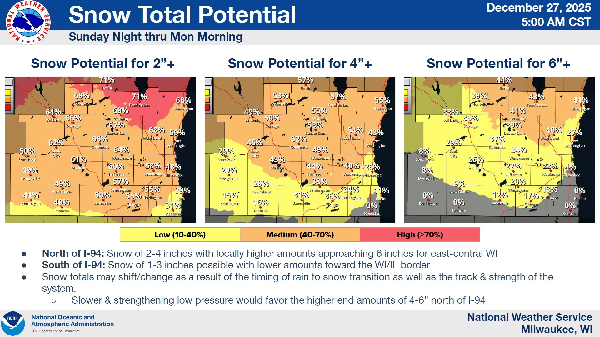
A potentially significant weather event is poised to threaten Sheboygan County and much of Wisconsin with hazardous weather beginning Sunday night. In southeast Wisconsin, counties north of an Ozaukee to Sauk County line are affected by the advisory that remains in effect until noon on Monday for snow accumulation of 2-4 inches on winds gusting to over 35 MPH during the snowfall. The culprit is an influx of arctic air plowing into the relatively mild an moist air we’ve been experiencing for the past week or so.
NWS Graphic
The system arrives with 40-degree rain late tonight that will likely fall in periods between 10 tonight and 9 PM Sunday. At that point, a passing cold front will cause a quick changeover to snow as temperatures are forced below freezing on northwest winds that become sustained at nearly 30 MPH and gust to over 40 by early Monday morning. Snowfall of around 4 inches (preliminary estimate of potential) in Sheboygan County is likely to be blown around on winds that drive wind chills below zero by Monday night, but the National Weather Service warns that some areas, including Sheboygan County, could see snow totals approach 6 inches. Addressing winds only, warnings would only be issued if winds are projected to be sustained at 40 MPH or greater for more than an hour, an unlikely case. Still, blowing and drifting snow could be a problem until Tuesday morning.

NWS Graphic
—————-Worse to the North—————
A Winter Storm Watch was issued for those counties north of here for 4-7 inches of snow on winds gusting as high as 50 MPH, causing considerable blowing and drifting, making travel difficult and likely downing some tree branches that cause power outages, especially in Door County. Anyone in the watch area is advised to monitor forecasts closely for local hazards.

NWS Graphic
Looking ahead, New Year’s Eve should be partly sunny with highs in the mid 20s, with wind chills below zero and a 30% chance of snow by midnight.


Comments