A seemingly nonstop train of disruptive weather systems continues marching through the state and the Sheboygan area.
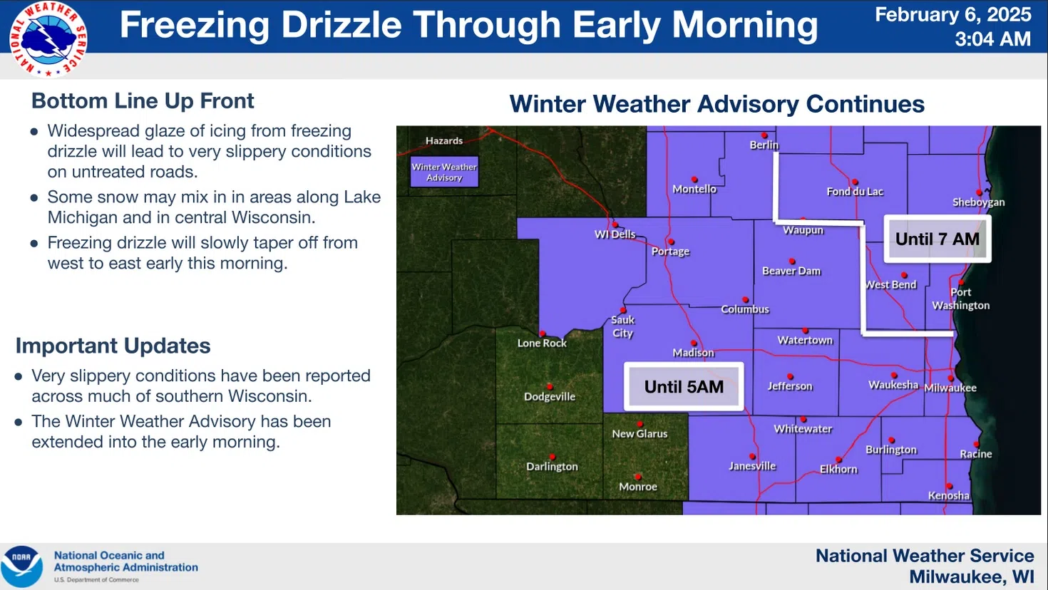
Overnight, a Winter Weather Advisory was extended northward to cover Sheboygan County for slippery conditions resulting from a combination of light snow showers and some freezing drizzle, although a lack of reports concerning trouble on the roads here was welcome. The advisory was posted until 7 a.m., but that doesn’t mean that Mother Nature was through with us.
A Wind Advisory is in effect between 9 this morning and 9 tonight for sustained west winds of 20-30 miles per hour, with gusts between 45 and 50 miles an hour. What previous wind systems didn’t blow out of yards and properties will again be threatened with forceful relocation, and a few power outages could result.
We’ll get a breather on Friday with sunshine and upper 20s, but winds will keep chill values between 5 below and 5 above zero. And then, there’s Saturday.
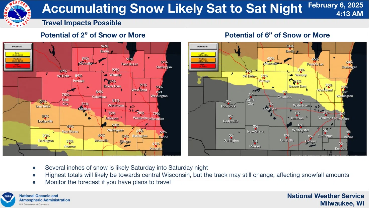
NWS Graphic Indicates Snow Potential for Saturday.
Forecasters are now expecting snow to overspread the area in the early morning hours, continuing through the afternoon and becoming heavy at times. With temps in the upper 20s and east winds of 5-15 mph, the snow shouldn’t be wet and heavy, but some drifting could occur.
There is plenty of uncertainty in the forecast, but there’s a potential of between 4 and 7 inches of snow in Sheboygan County – heaviest toward the northeast in the Cleveland area and lightest toward the southwest border with Washington and Fond du Lac Counties. What is certain is the likelihood of horrible travel conditions, and the significant influx of cold air that follows for next week. Keep up with the forecasts!


Comments