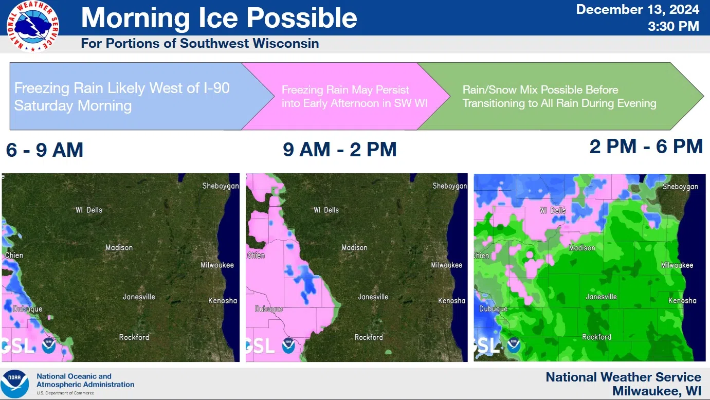
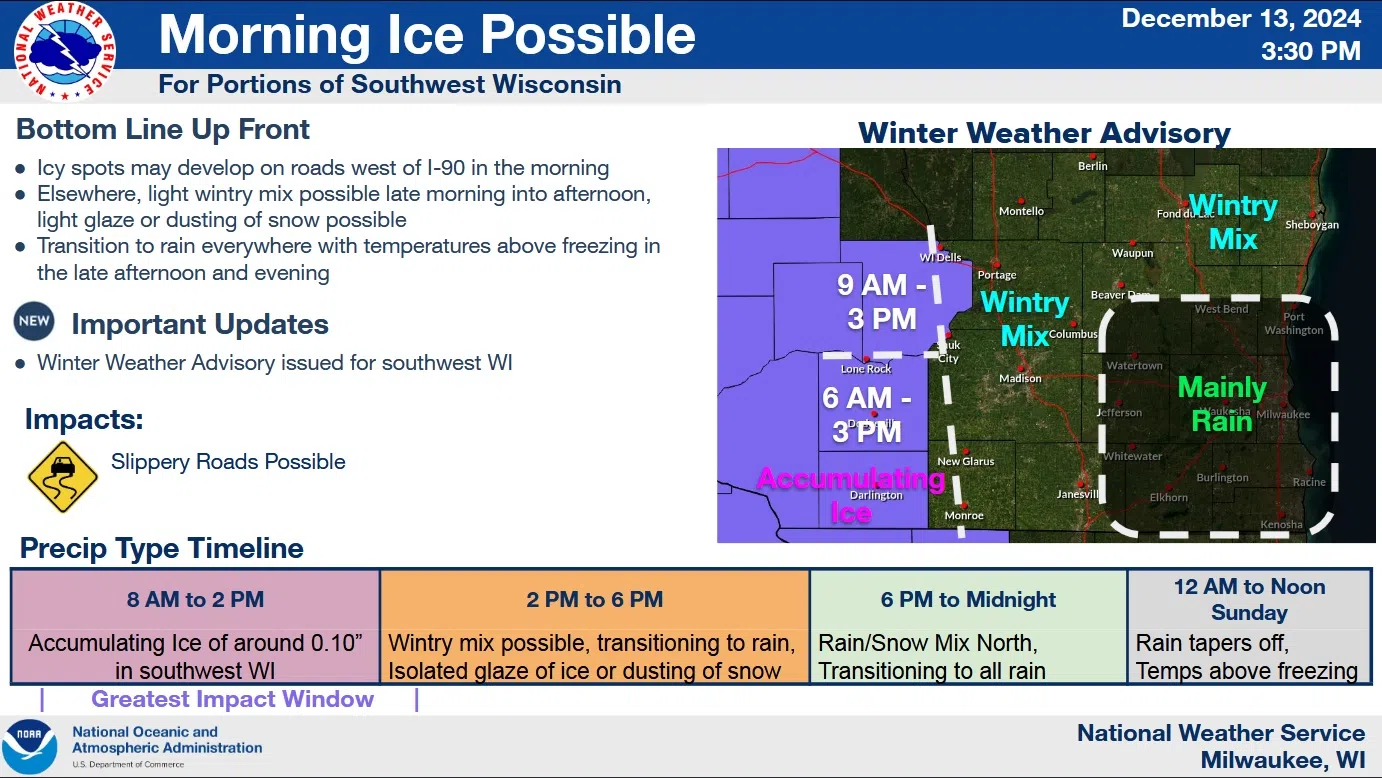
The risk of slippery roads may be greatest in southwestern Wisconsin, but National Weather Service forecasters aren’t giving east-central Wisconsin a pass on possible messy conditions on Saturday.
The latest forecasts have increasingly focused on an area of freezing rain impacting southwest Wisconsin between 6 and 9 am, and south-central Wisconsin between 8 and 10 a.m. Around a tenth of an inch of ice could accumulate on exposed surfaces. All precipitation will progress eastward, but there’s a big question mark on the eastward extent of the freezing rain.
Air temperatures will gradually rise above freezing during the day Saturday, but ground and road surfaces will take longer to warm above critical levels, and forecasters say a glaze is likely on pavement, particularly in shaded and low-lying areas.

NWS Graphic
For the Sheboygan area, things should begin dry with a wintery mix dominated by snow is likely between 5 and 9 p.m, with a tendency towards all rain by 10 p.m. Temperatures are expected to remain a degree or two above freezing during the day, with a rise of two or three degrees overnight into Sunday. The chance of light rain remains in the forecast until Monday evening with temperatures by then in the mid 40s.


Comments