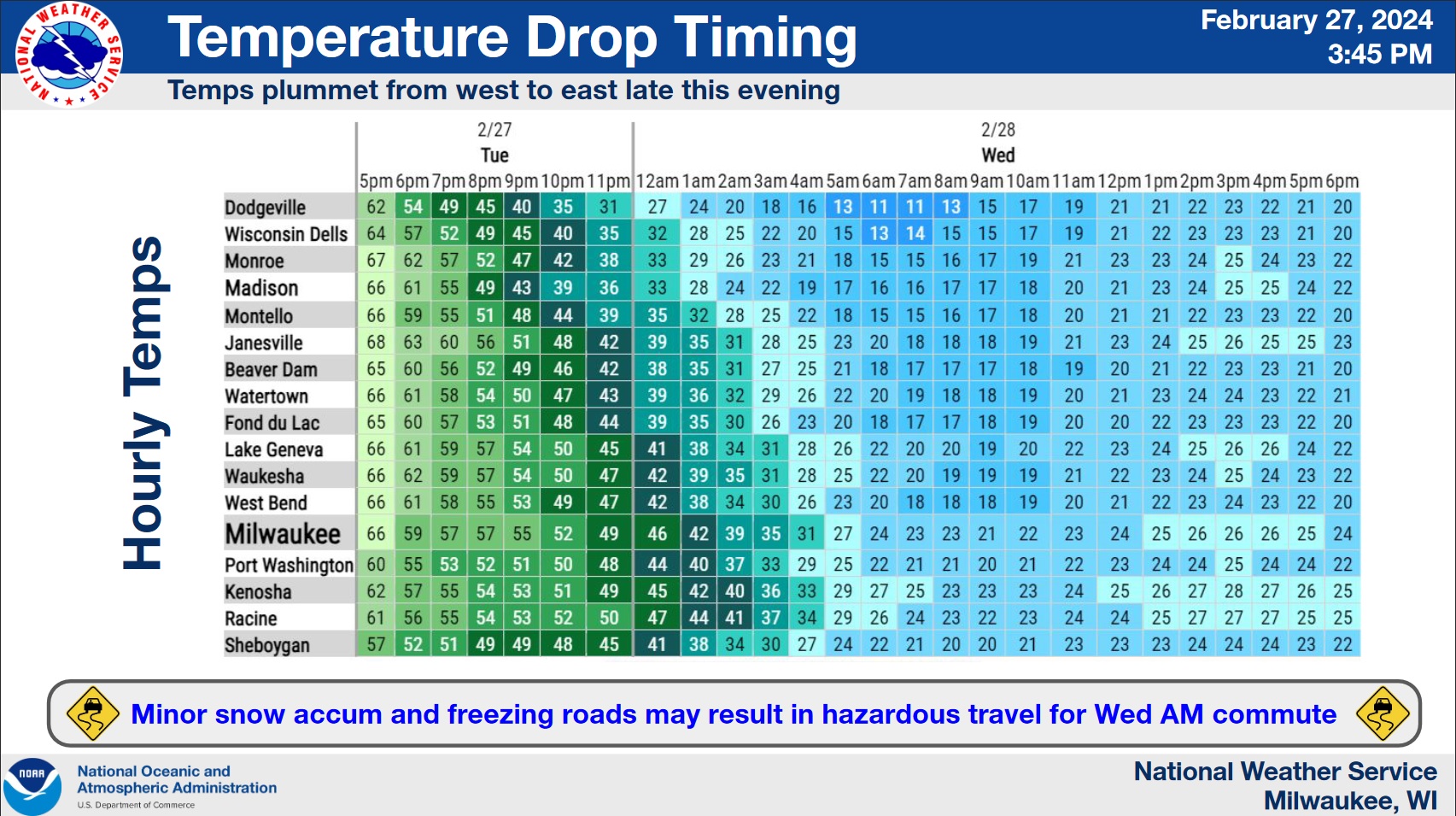
The temperature at the Sheboygan County Memorial Airport, where the National Weather Service collects its official data, reached 70 degrees shortly before 2 p.m. on Tuesday – a new record high for the day and for the month of February overall. Much of Wisconsin experienced similarly remarkable temperatures as southwest winds ahead of a powerful cold front ushered in the warmest air so far for 2024.
That cold front promises a rude jolt back to reality, opening the path for an invasion of arctic air that could see a 50-degree drop in temperatures to 20 degrees by daybreak on Wednesday while winds gusting to nearly 40 miles per hour will likely push chill values as low as 3 above zero. Wind chill values are then expected to remain in the single digits until mid Thursday morning.
Rains between 9 p.m. and 2 a.m. tonight should transition to snow by 3 a.m., with a flash-freeze of wet roads being overcoated with around an inch of snow, creating a slippery morning commute. While there are no advisories in effect, travelers should remember that winter still has over three weeks remaining and to expect to drive accordingly.




Comments