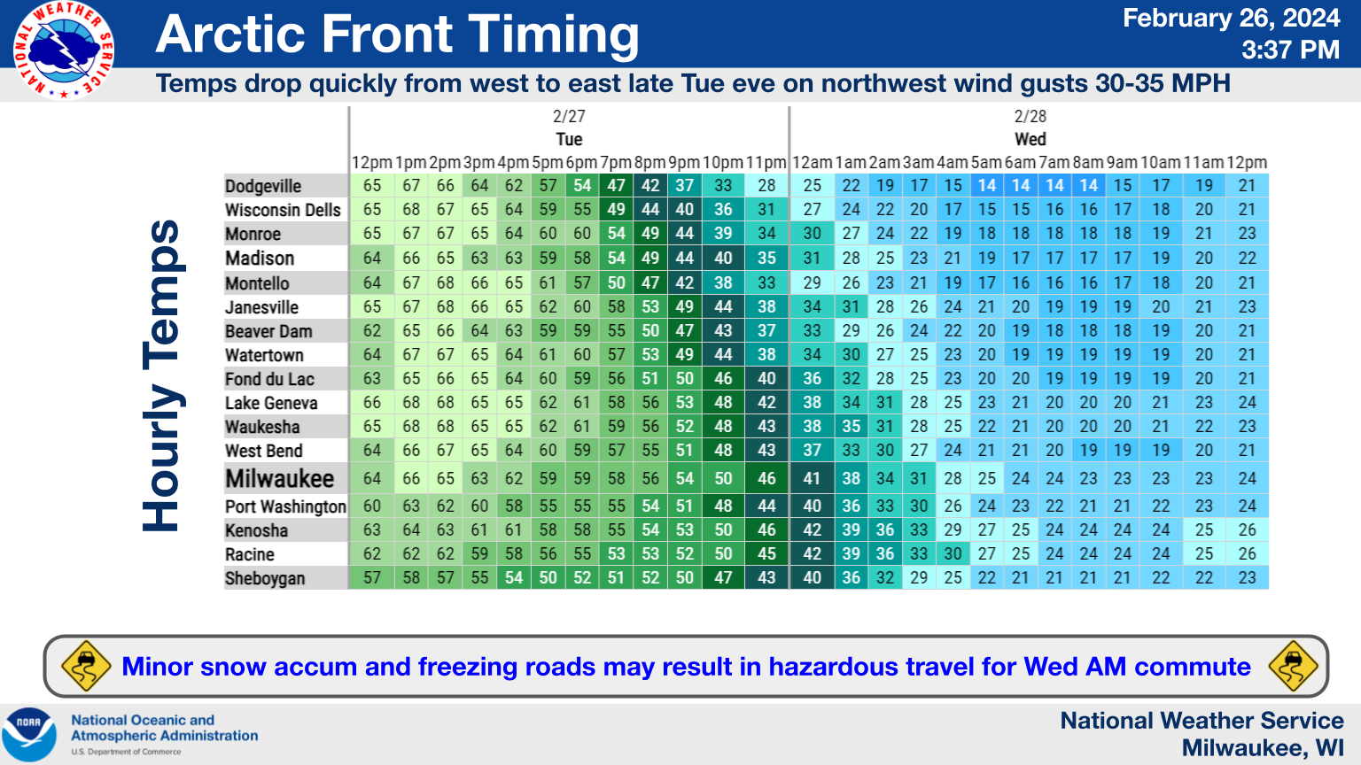
It’s a phrase often quoted, but perhaps no more valid than here in the Badgerland: “If you don’t like the weather now, just wait a minute.” On Tuesday night, a wave of such change is expected to course through the state as unusually – by February standards – warm, springlike air, is forcefully confronted by a surge of a more seasonable wintery cold airmass on Tuesday night. While there’s no doubt that the eventual winner will be winter, the ensuing battle could get messy. As for the Sheboygan County area in particular, we may be fortunate to watch the worst results stay some distance away, but still need to adjust for the changes in store.
The chance that severe thunderstorms containing large hail and damaging winds is greatest in Racine and Kenosha Counties, reaching a risk level of 2 out of 5. The southeast quarter of Sheboygan County falls into a 1 in 5 risk, while a slight risk extends from there northward through Door County. Forecasters now expect any rain here to happen after midnight, with the risk of thunderstorms rapidly replaced by plunging temperatures driven on strong northwest winds. Evening temperatures in the low 50s will likely be driven into the 30s by midnight, with any rain changing to snow after 3 a.m., enabling a possible flash-freeze of wet roads threatening Wednesday’s morning commute.
The surge of winter now appears to be short-lived, however, with above-normal temperatures in the mid-upper 40s returning by Friday.
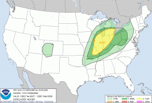
The Risk of Severe Thunderstorms Extends Into Wisconsin on Tuesday. Graphic Courtesy of NOAA




Comments