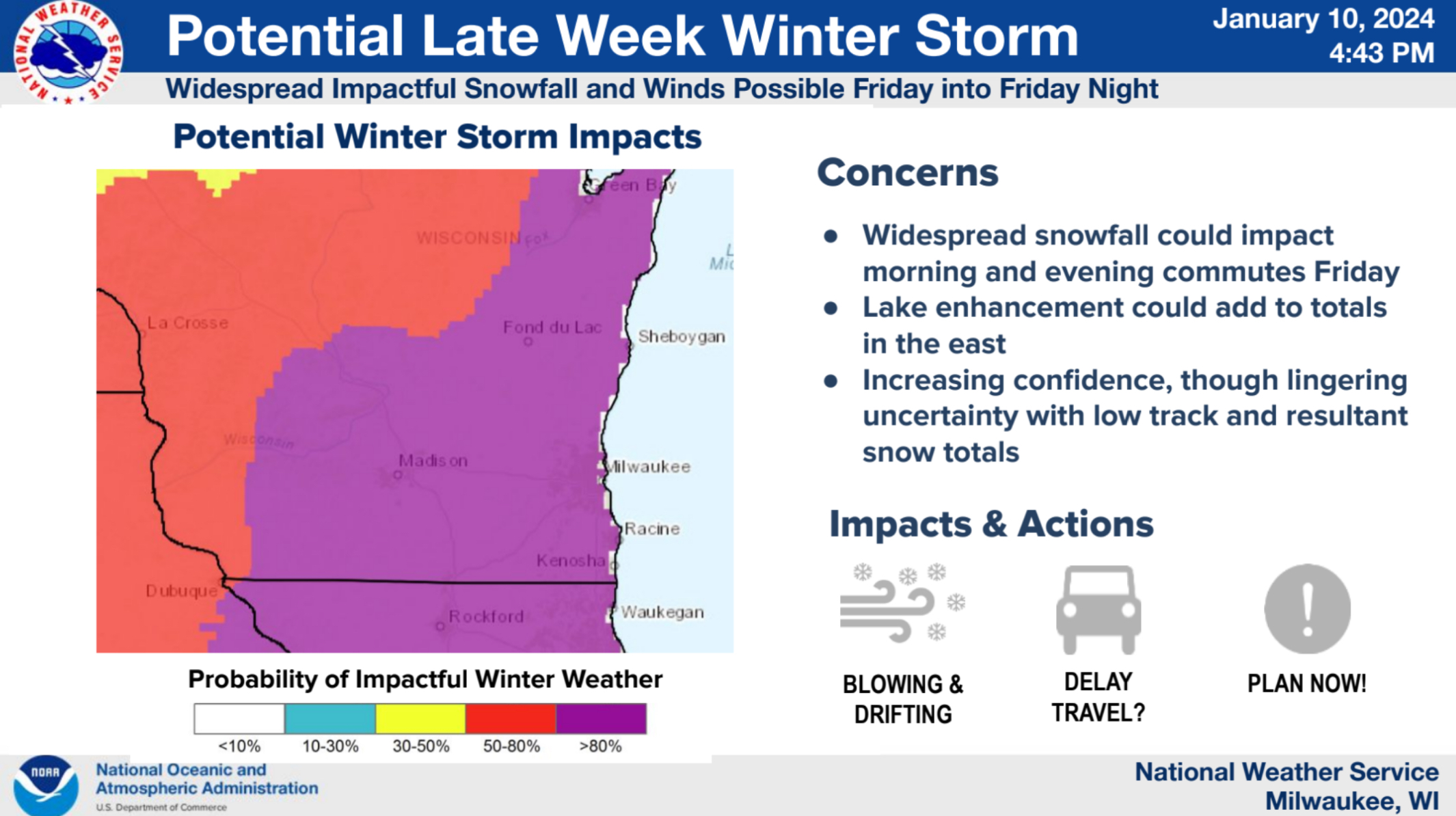
The second major winter storm within a week is now organizing to our southwest, and is prompting issuance of Winter Storm Watches through a large portion of the nation’s midsection from Wyoming to Michigan. For the Sheboygan area, another large question mark will loom over forecasts as the influence of Lake Michigan once again could hold down snow totals in its vicinity, while simultaneously adding to moisture available to turn into snow.
Before Friday’s storm, though, a quick Wednesday night – early Thursday morning event could deposit an inch or two of light, fluffy snow across the area, prompting a Winter Weather Advisory, but then followed by a welcome break. But by the pre-dawn hours on Friday the next main event may already have begun.
The current scenario suggests heavy snow with accumulations of 6 or more inches possible. For Sheboygan County in particular, forecast snowfalls range from 6-10 inches in the southeast corner of the county near Cedar Grove, up to between 7 inches and 1-foot of snow in Plymouth. Wind gusts of 40 to 50 miles an hour could result in significant blowing and drifting snowfall, especially Friday afternoon into Friday night.
As a result, forecasters say travel could become very difficult, impacting both the Friday morning and evening commutes, while the winds also pose a risk of downing tree branches, which can result in power outages.
As always for winter storms in this part of the world, forecasts can change significantly within a few hours, and so meteorologists try to look at the worst scenario and advise that for now, prepare for that worst outcome and keep up with forecasts.
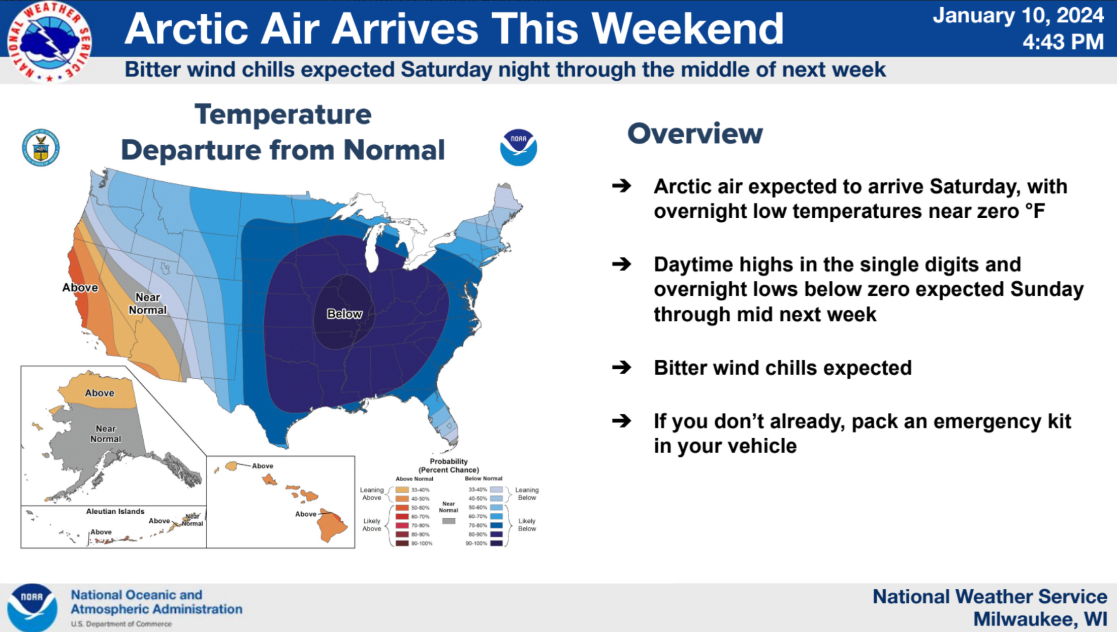
Once thing appears certain: unlike previous storms, this one opens the door to the arctic, flooding Wisconsin in its first sub-zero airmass of the season, and sending windchills dangerously towards minus 25 and colder by early Monday and Tuesday mornings.




Comments