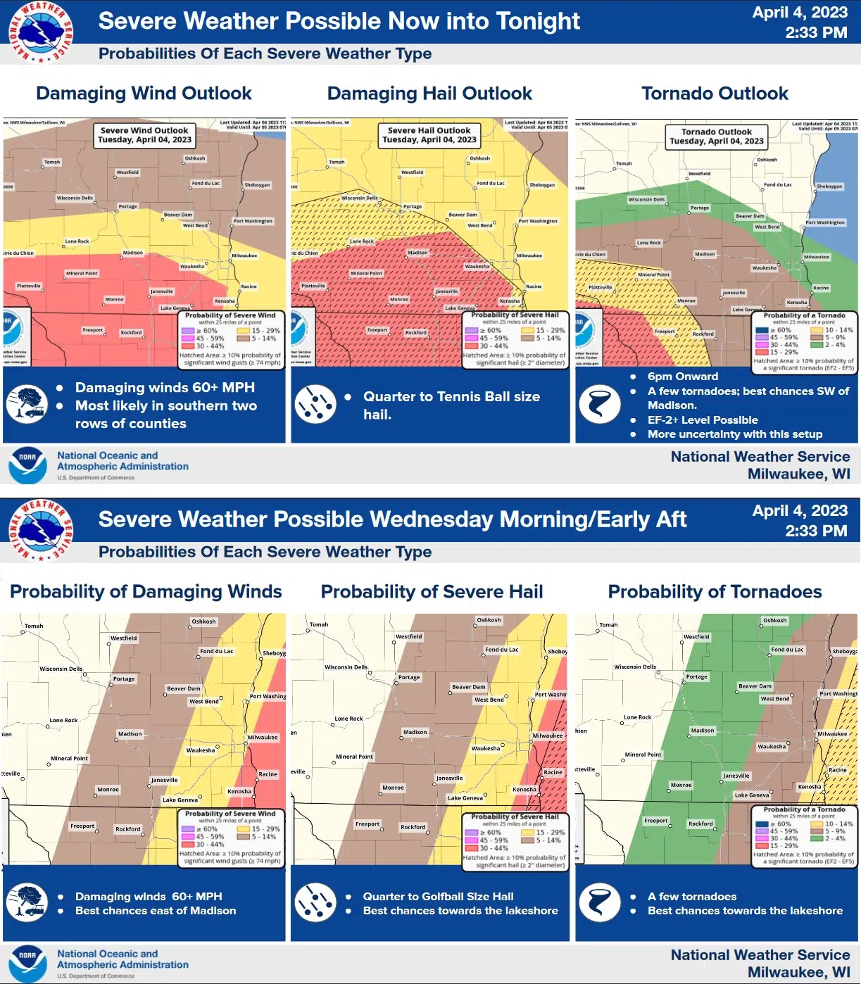
Uncertainty abounds among forecasters tasked with informing the public what they can expect from the latest spring storm taking shape over Wisconsin and surrounding states. Even within the state, defining who gets what must be stated in probabilities, as almost anything could happen…or as forecasters put it: “All hazards will be possible” now through early afternoon Wednesday.
Of most immediate concern as of Tuesday afternoon was the risk of “training” rains, or thunderstorm cells following one another along a straight line, dumping repeated rains on the same area as they do. For that possibility, a Flood Watch was issued from 7 p.m. until 4 a.m. Wednesday. Widespread 1/2 to 1” rains are expected, while the training storms could involve higher totals.
With the focus of severe thunderstorms being a warm front draped across northern Illinois that will lift into southern Wisconsin, Sheboygan County is placed in a category of lesser threats. Most significant here will be that rain, along with a 15-29 percent chance of severe hail of quarter, to tennis-ball size through the overnight hours, along with a lesser chance of damaging winds.
On Wednesday morning through early afternoon, the chance of damaging winds and hail continues, along with the outside chance of tornadoes.
Forecasters are urging people to have multiple ways of receiving emergency information, and to be prepared just in case severe weather warnings are issued.


Comments