An evolving spring storm has the Sheboygan area on the lookout for several weather threats over the next 48 hours.
Fog that moved onshore from Lake Michigan has expanded northward during the midday, triggering a Dense Fog Advisory to be in effect until 6 AM Friday for visibilities of a quarter mile or less. The advisory, affecting Sheboygan and Ozaukee Counties, joins others in counties to the south that had been dealing with reduced visibility since before sunup Thursday.
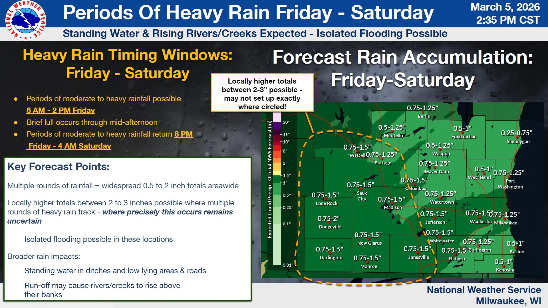
Attention then rests on the possibility for heavy rain and severe thunderstorm activity on Friday. Multiple rounds of rain are expected, morning, afternoon and night. Any storms in the afternoon will depend upon alignment of an advancing warm front, and confidence is low surrounding those chances. Rain could add up to a third of an inch or so in the morning, while another third could happen in the late afternoon to overnight hours. While not usually a threat, those amounts falling on frozen ground pose the risk of ponding and runoff.
NWS Graphic
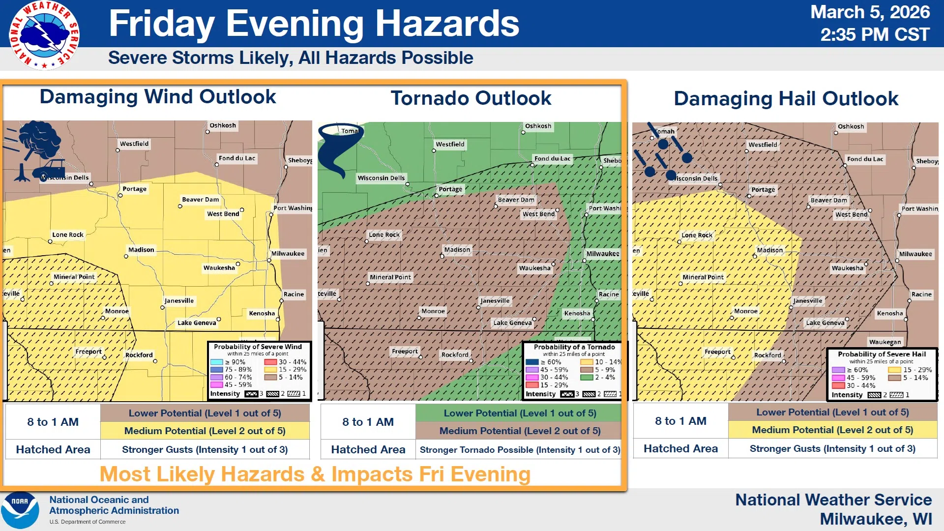
Greater attention is being given to an increasing risk of severe thunderstorm activity featuring hail, high winds, heavy rain, and even the slight chance of a tornado between 8 PM Friday and 1 AM Saturday in southern Wisconsin. The greatest threat of severe thunderstorm activity is well to our southwest, but we’re still given a 1 in 5 level of risk. Forecasters are also watching for possible rainfall of between 2 and 3 inches in some locations, but again, uncertainty is high.
Weather that follows this weekend now appears to offer a cloudy Saturday with falling temperatures, and a breezy, sunny Sunday with highs in the mid 50s.


Comments