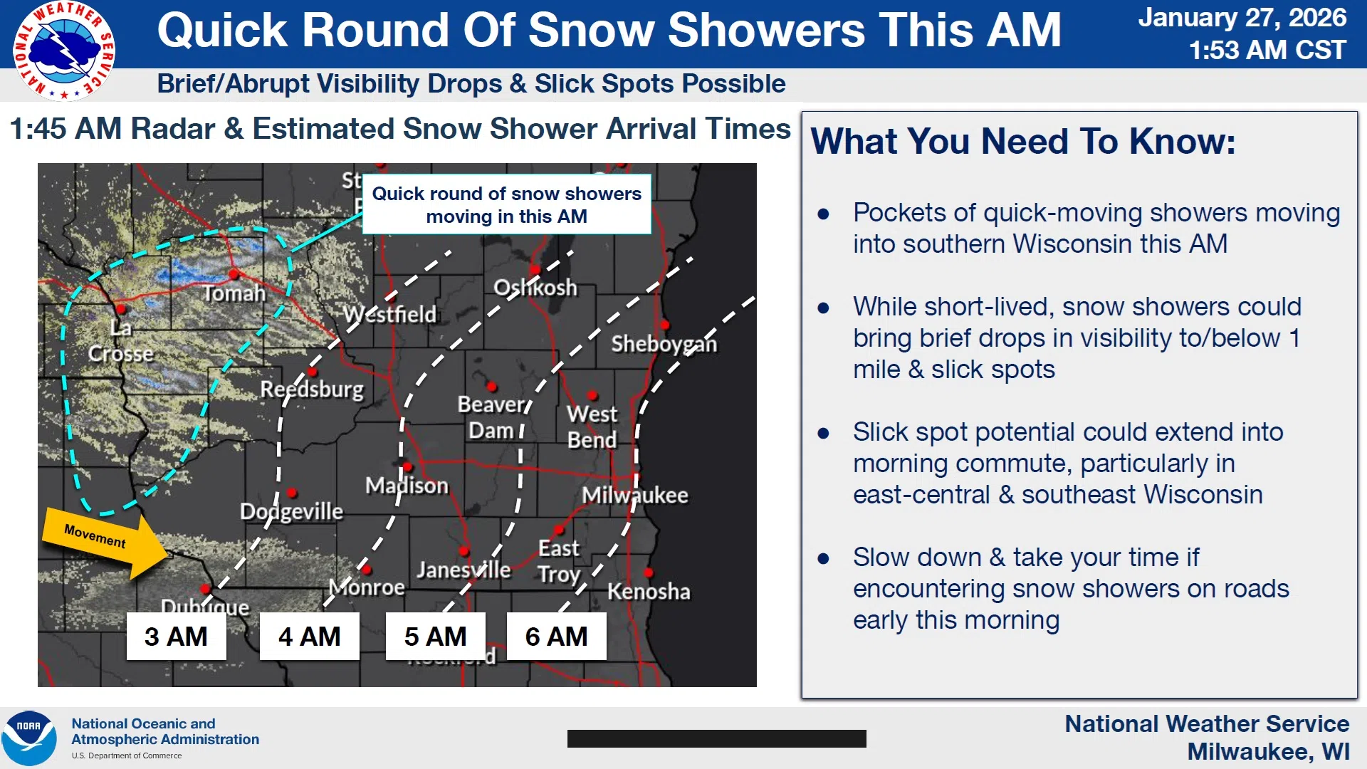
A weak cold front and its accompanying light snow showers moving through the area this morning is likely to cause brief drops in visibility and some scattered slippery road surfaces.
The National Weather Service expected that activity by 6 AM in Sheboygan County, and while the fine, powdery snow won’t add up to much and won’t be general in coverage, gusty winds will keep that snow mobile and drive wind chills into the teens below zero. Whatever does fall was expected to end by 10 AM.
With temperatures not expected to rise much above 10º for the rest of the workweek, it now looks like wind chills will remain below zero until sometime on Saturday.


Comments