While no storms comparable to that of a week ago are expected, a pair of “Alberta Clipper” weather systems could still make for slick conditions this weekend.
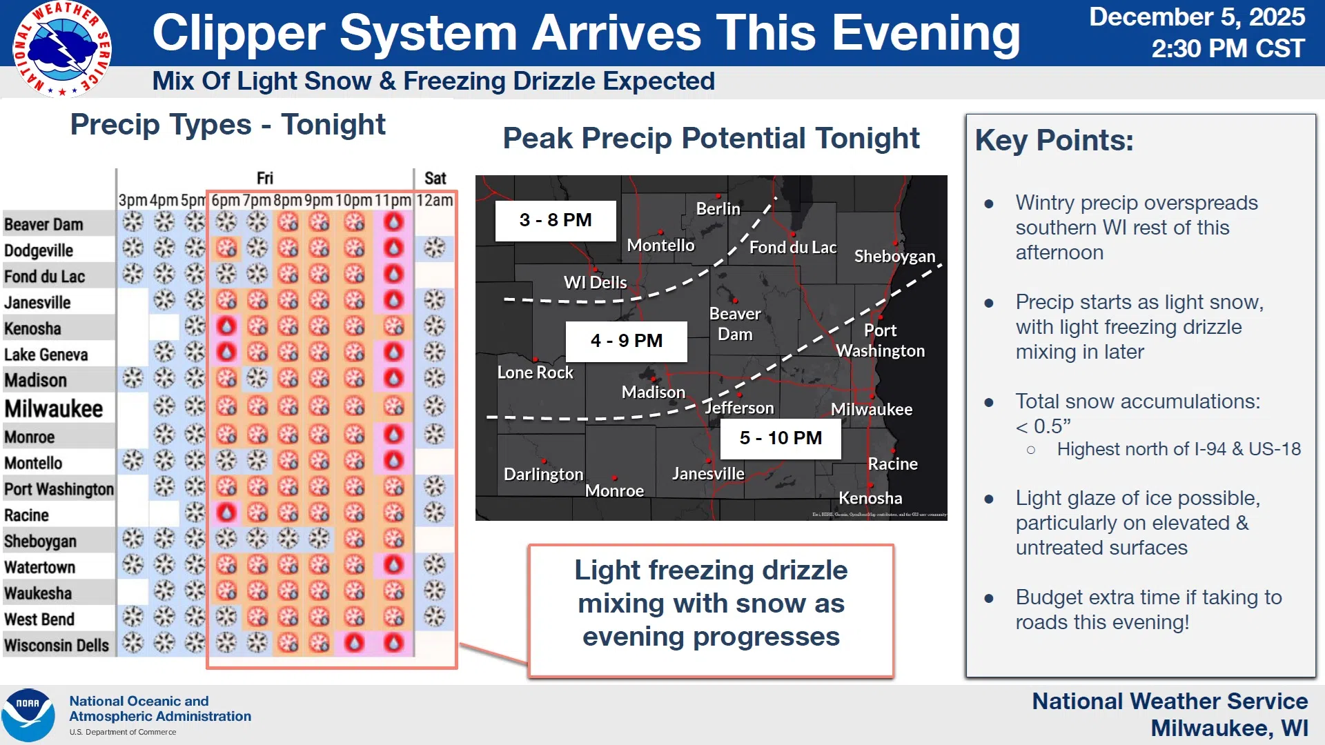
Round 1 should begin as light snow this afternoon, with some light freezing drizzle mixing in later this evening. Precipitation should become more common through the evening hours, with the freezing drizzle window between 10 PM and Midnight. Even with accumulations measured in the tenths of an inch, freezing drizzle would guarantee hazardous travel should it occur.
NWS Graphic
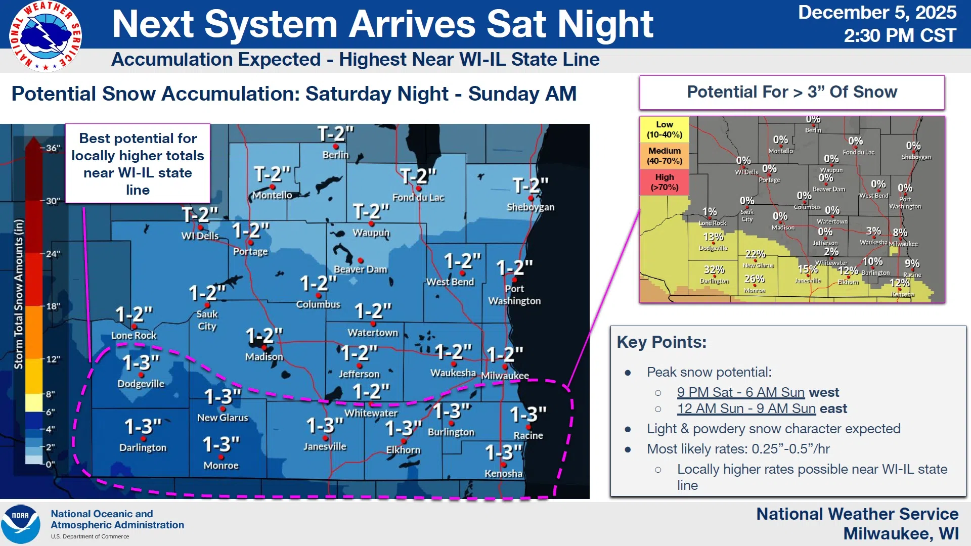
Round 2 looks a little more productive for snow, with anywhere from a trace to 2 inches of light, fluffy snow not unlikely across the county. Most should fall between 12 and 9 AM on Sunday. Colder temperatures will eliminate the possibility of freezing drizzle, and heavier snowfalls of 1-3 inches will likely be limited to counties bordering Illinois.


Comments