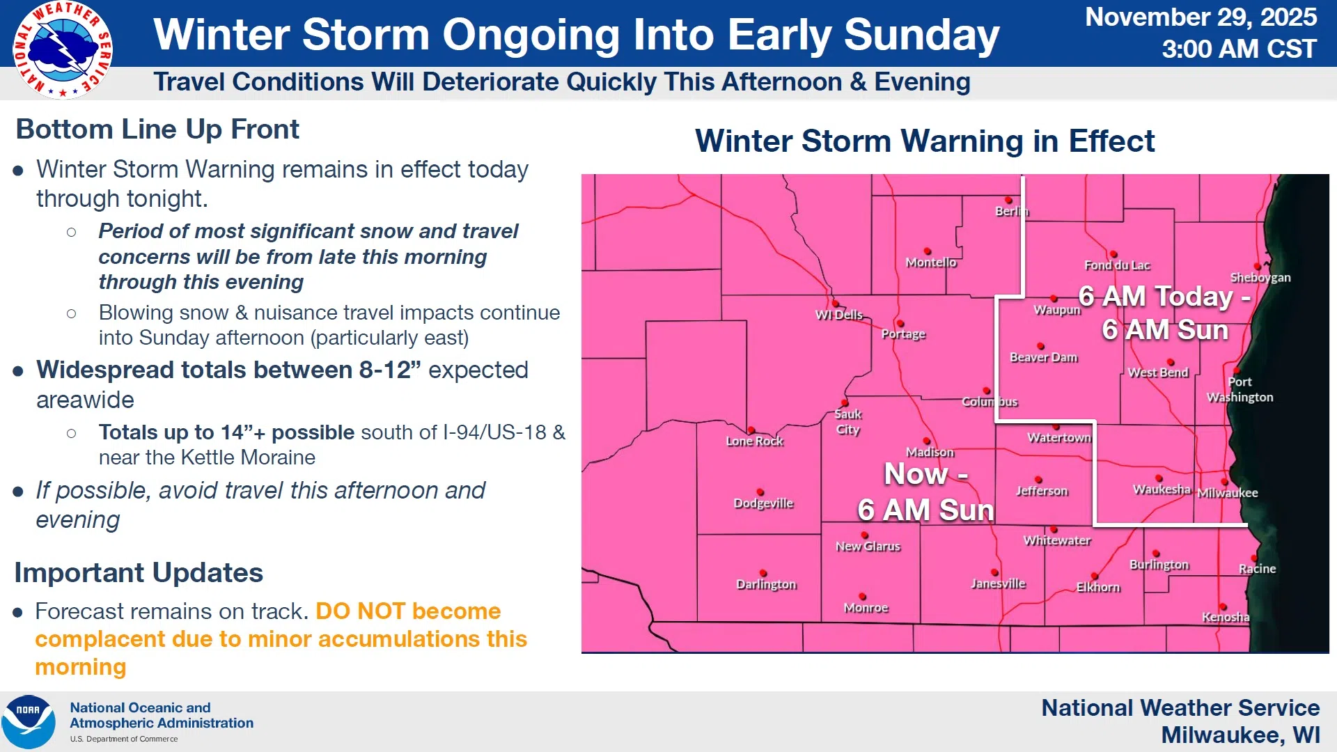
The latest forecasts from the National Weather Service look much like previous ones, and that’s not comforting news. The consistent projections make it very likely that Sheboygan County, along with most of the nation’s Great Lakes and upper Midwest, will be dealing with around a foot of snow – give or take. And that has a Winter Storm Warning solidly in place from now until 6 AM Sunday.
NWS Graphic
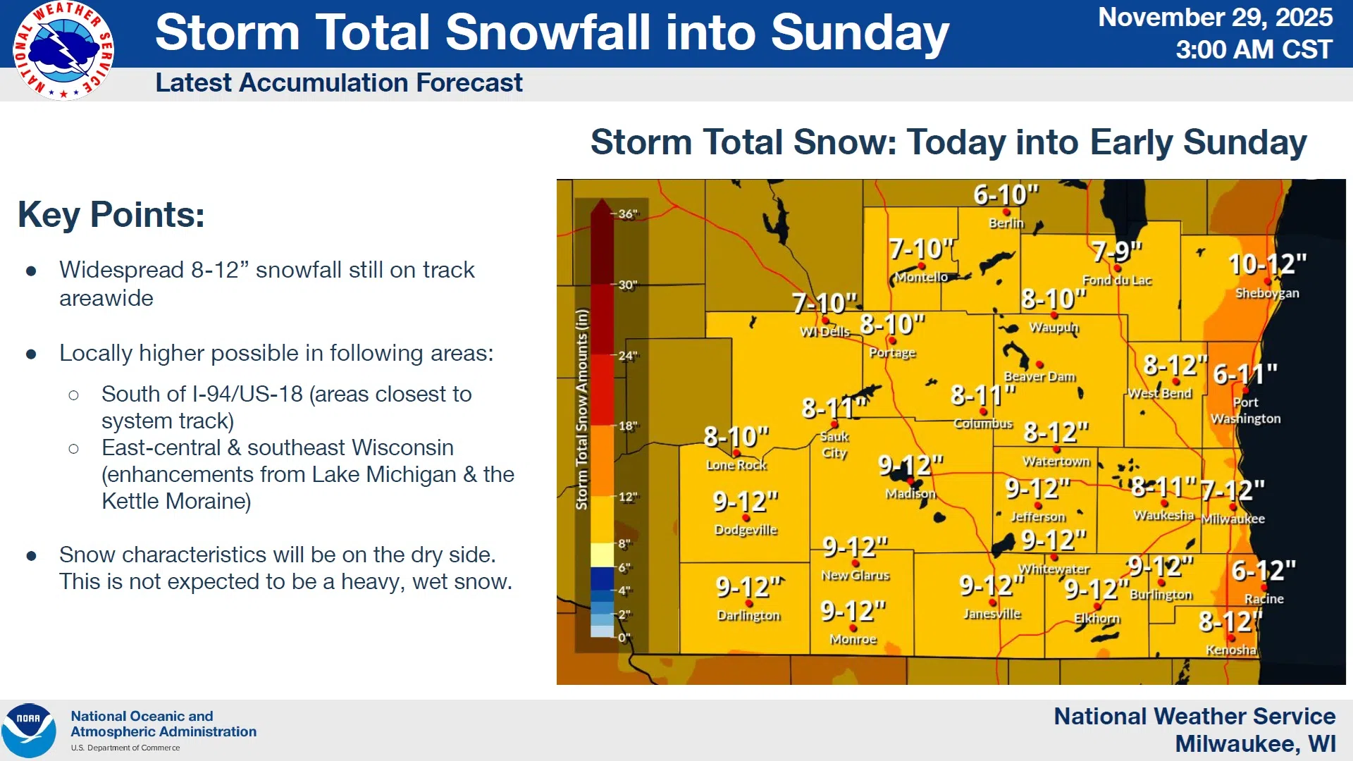
Sheboygan and surrounding counties are looking at snow accumulations anywhere from 8 inches, up to a foot of snow, with possible enhancement from Lake Michigan producing even more in select spots. Those would be near the Kettle Moraine in particular where the higher elevation and placement inland of Lake Michigan warmth turns the extra moisture into extra snow…but that’s not at all certain.
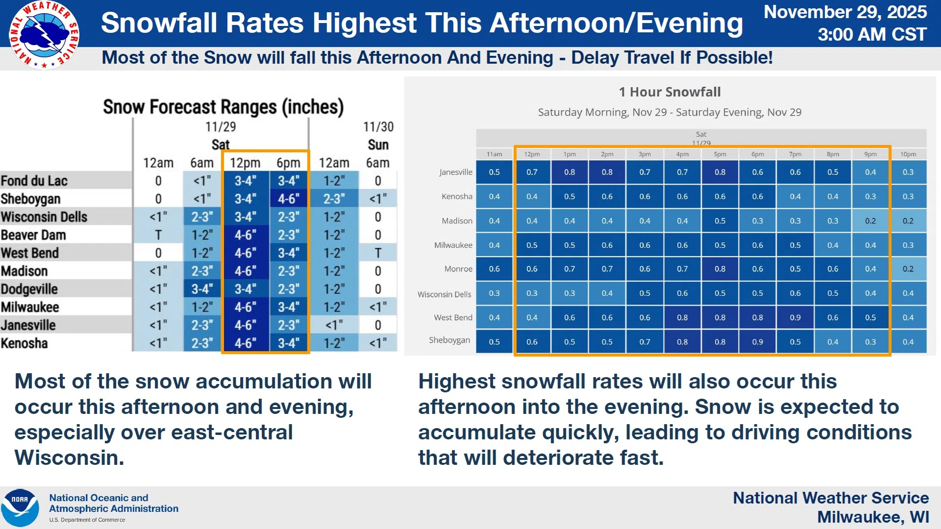
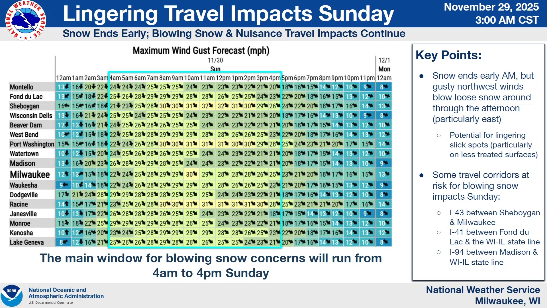
What is certain is that travel will most likely be very difficult, especially during the afternoon and evening hours when snowfall rates will be up to an inch per hour, followed by blowing and drifting snow on Sunday between 4 AM and 4 PM on northwest winds of 30-35 MPH. Assuming that materializes, one could expect a Winter Weather Advisory to be issued on Sunday morning.
NWS Graphic
The National Weather Service is advising travelers to delay any holiday travel planned between now and Sunday morning, and even then, pay attention to the forecasts for possible problems.
NWS Graphic


Comments