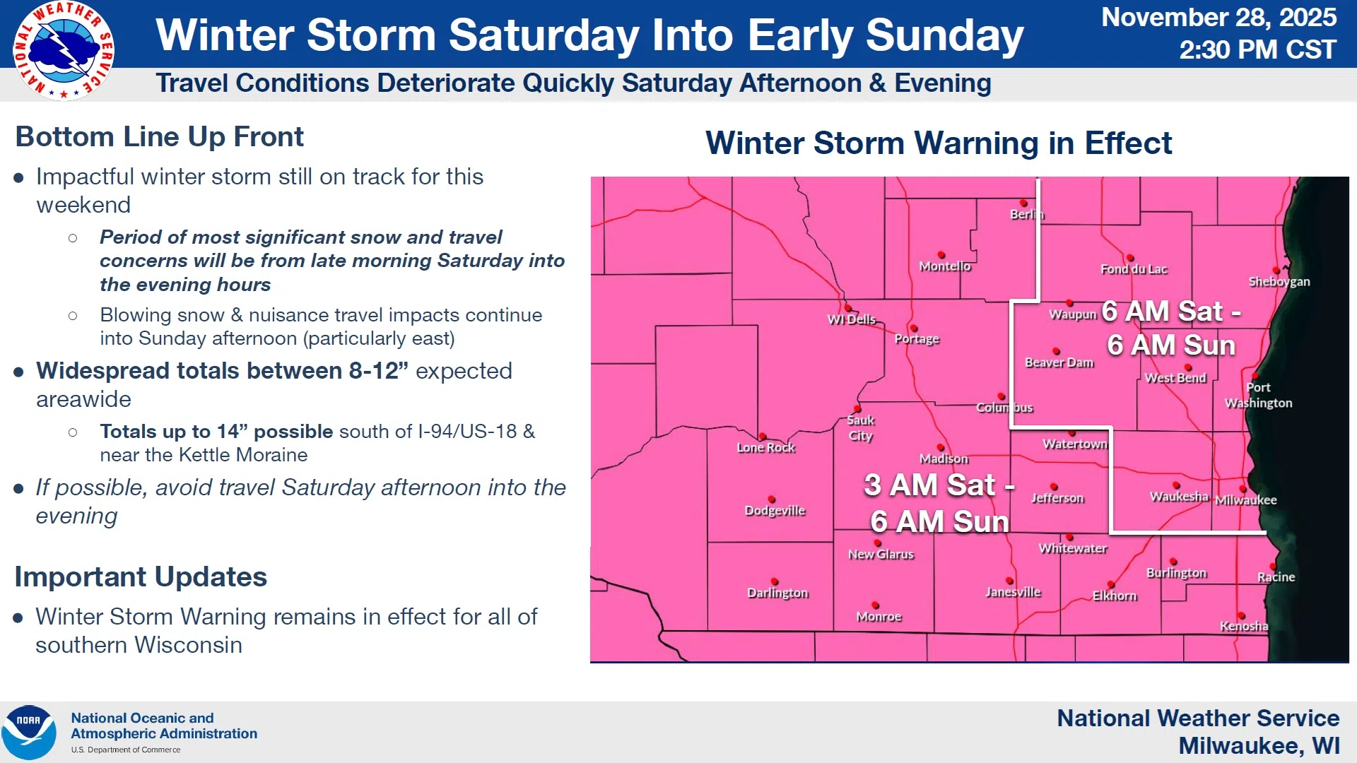
The impending winter storm expected to begin Saturday morning was given a close look by the National Weather Service in a Friday afternoon conference. As of now, it appears it would be wise to prepare for a heavy-duty storm impacting us for at least 24-hours beginning around sunrise Saturday.
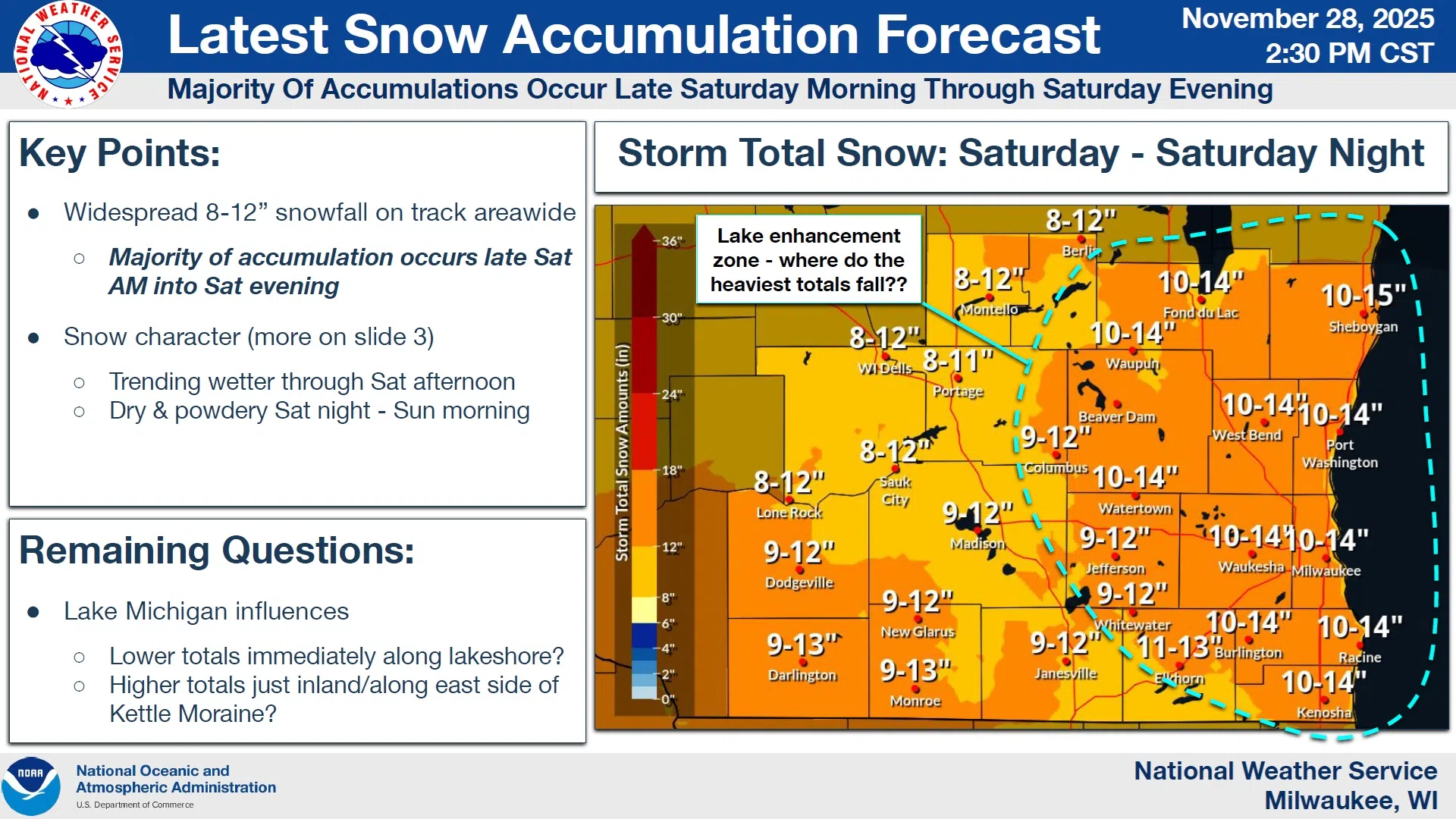
At that time, light snow is expected to begin falling from southwest to northeast through our area. Accordingly, a Winter Storm Warning has been issued to be in effect from 6 AM Saturday until 6 AM Sunday. A widespread snowfall of between 8 and 12 inches is expected, with locally heavier snowfall possible in counties bordering Lake Michigan. Even then, nailing down total accumulations becomes tricky.
NWS Graphic
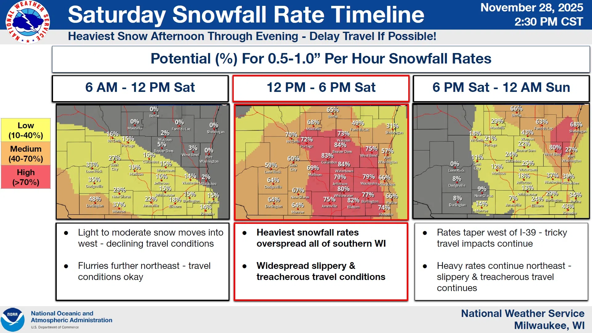
The heaviest snowfalls and resulting travel impacts overall are expected from late Saturday morning through Saturday evening when snow is expected to accumulate at one-inch-per-hour rates. And while snow will be ending Sunday morning, blowing and drifting snow will be possible through Sunday evening, extending slippery road conditions – especially on North-South Roadways. If that scenario appears imminent, a Winter Weather Advisory could be expected to follow the expiring Winter Storm Warning.
For Sheboygan and other lakeshore counties, forecasts are subject to small nuances that can have large impacts. While Lake Michigan is a bit warmer than usual – and consequently able to provide a little extra “kick” in terms of energy and moisture – that can also lead to wetter snow and lesser accumulations within close proximity to the water. On the other hand, moisture blown up the eastern contours of the Kettle Moraine in the colder inland areas can energize snow production, and that’s where the highest amounts of 14, maybe 15 inches, could occur.
NWS Graphic
Typical of such systems, an influx of cold air will follow, deep-freezing whatever falls and setting the stage for a cold start to December.


Comments