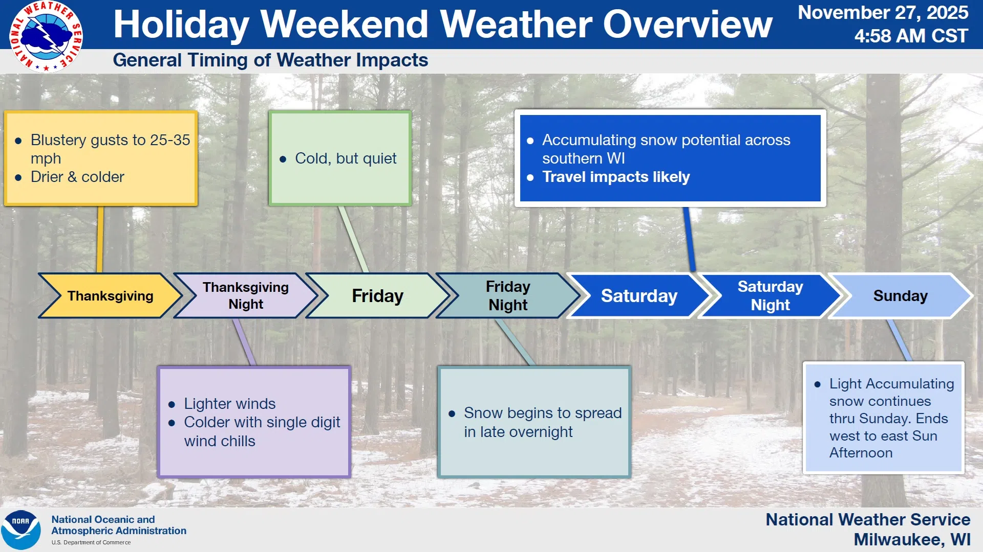
The public is being warned to keep up with weather forecasts as a busy holiday travel weekend approaches. The focus is on a developing weather system, loaded with both moisture and energy, that will cross the nation’s midsection beginning early Saturday and exiting our area on Sunday afternoon.
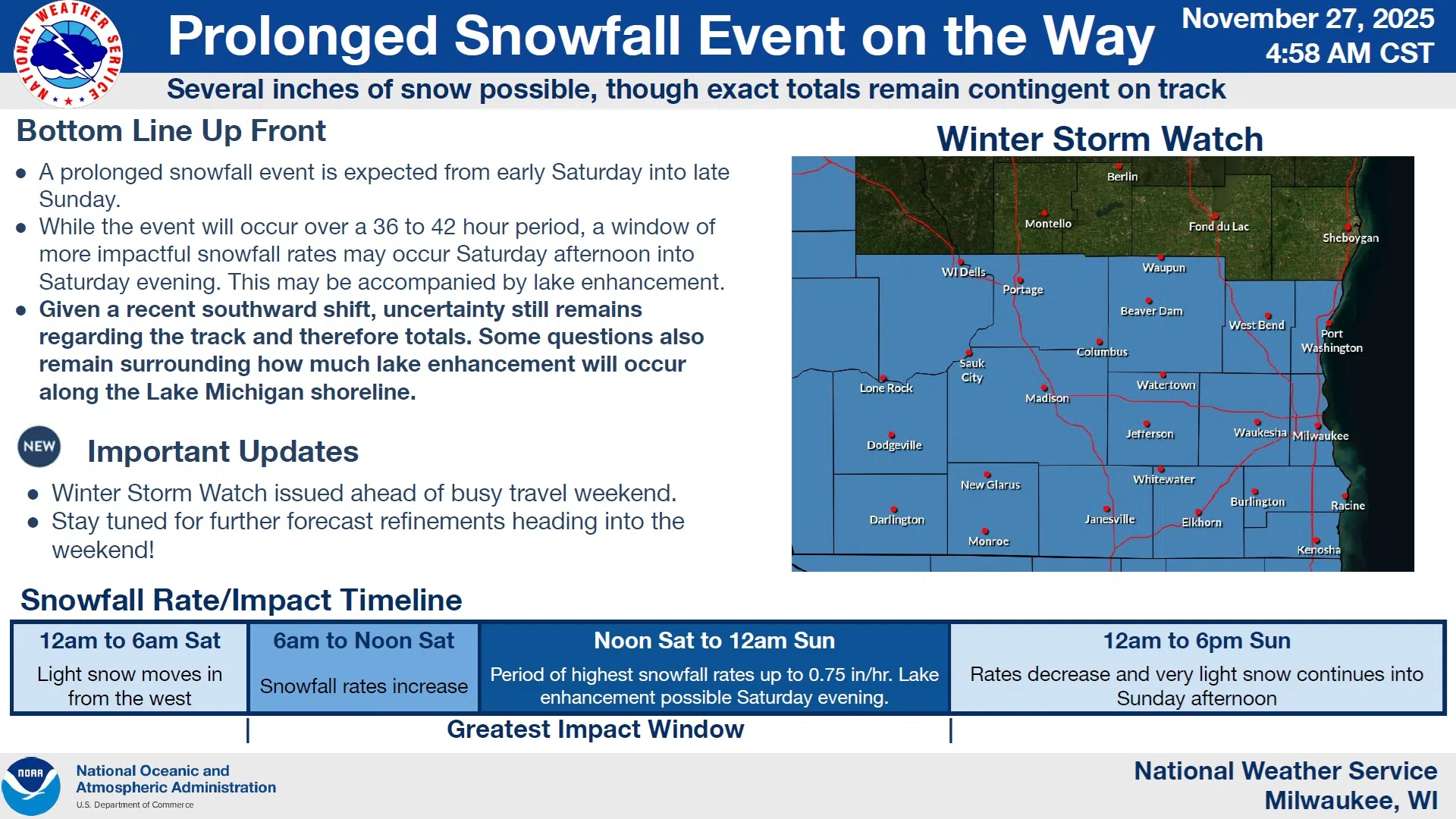
While uncertainty still prevails, the ingredients needed to produce an 8-inch snowfall over much of southern Wisconsin will be present, with details of the exact storm path remaining to be extracted from the models. A more northerly track would favor heavier snow here, while a more southern track keeps the heaviest to our south. Currently that’s the most likely, and a Winter Storm Watch was issued for Ozaukee through Kenosha Counties on the east, extending west to the Mississippi for late Friday night through late Saturday night.
NWS Graphic
Although Sheboygan County isn’t included in the watch, there is a better-than 70% potential for over 8 inches of snow accumulation through Sunday evening, with the greatest impacts between noon Saturday and noon on Sunday.
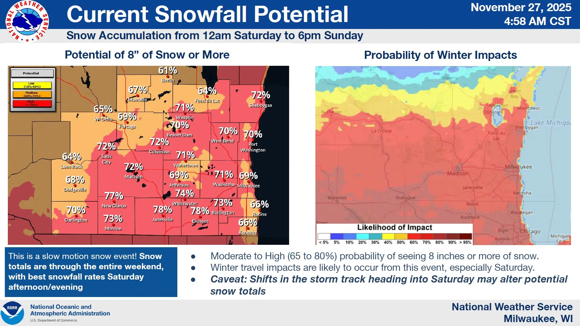
NWS Graphic
Once departed, the storm introduces single-digit and teens temperatures along with below zero wind chills to dominate the beginning of the week. Once again – keep up with the forecasts!


Comments