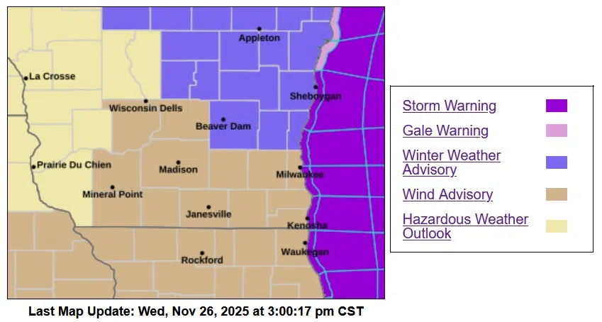
A burst of wintery bluster blew across Sheboygan County this Wednesday, producing flurries and small pockets of more vigorous snow with reduced visibility, but by far dominated by gusty westerly winds. Gusts began exceeding 40 MPH shortly before 9 AM at the Sheboygan County Airport, and regularly reached 45 MPH between 1 and 2 PM. And although snow was in the air, it wasn’t much on the ground as warmer pavement helped road conditions stay in good shape in the face of below-freezing air temperatures.
While that might seem “tame” for landlubbers, this did not apply on the angry waters of Lake Michigan. A storm warning was in effect until midnight Wednesday for winds of 35-45 knots with higher gusts, and waves of 17-22 feet. Under such conditions, damage to vessels, or even capsizing, is a considerable risk.
While advisories for winter weather on land last only until 6 PM Wednesday, another storm system will soon cause new concern. Preliminary estimates of snow totals falling in Sheboygan County from early Saturday through late Sunday are running in the neighborhood of 12 inches…strictly unofficial for forecast purposes, however enough moisture and cold air should be available to accomplish a 1-foot snowfall under ideal conditions.
Temperatures during that event start near freezing, but by the end of snow on Sunday they take a dive to around 10 above zero, with wind chills of around 4 below greeting early risers on Monday morning.


Comments