A challenging forecast for meteorologists has turned a bit more favorable for the public as a complex set of weather systems is changing its character by the hour.
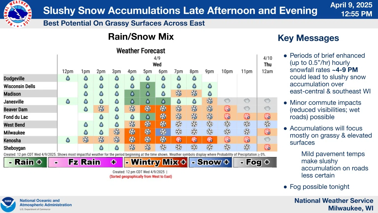
Converging elements had threatened an inch or two of wet snow, which now seems to be dismissed as a minor inconvenience, likely limited to only grassy surfaces and raised areas.
Rain was to raise the curtain on the whole event early this afternoon, but dry air delayed its debut, and along with a bit of sunshine, changed the course for the remainder of the event.
It’s still possible that we’ll see brief enhancement of snowfall rates up to a half inch per hour between 4 and 9 p.m., but only wet roadways were anticipated. Of more concern is the possibility that fog will impede visibility overnight.
Thursday will seem like a hangover from the night’s events, with clouds and light showers lingering. But with dry weather to follow, Friday offers more sunshine with a high around 50, eventually leading to a hoped-for high of near 60 for Monday.


Comments