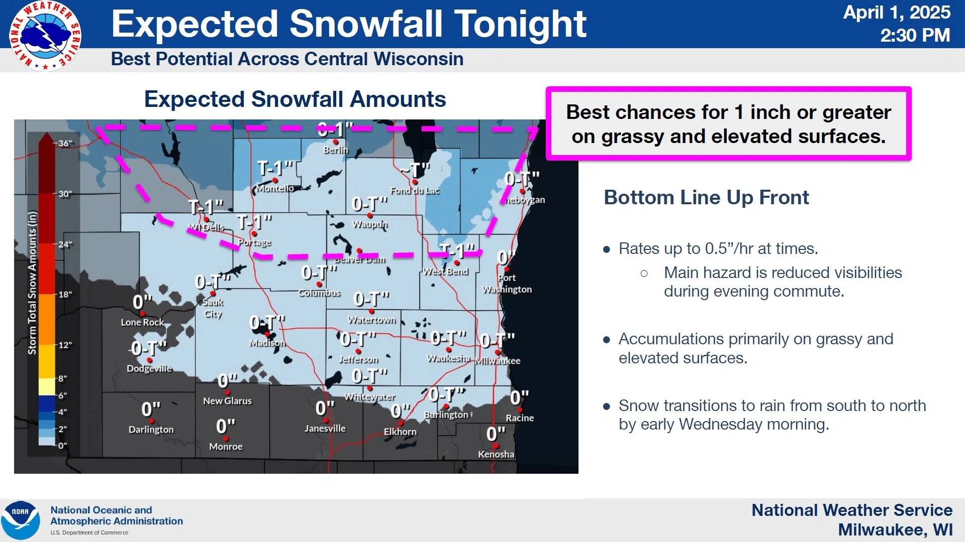
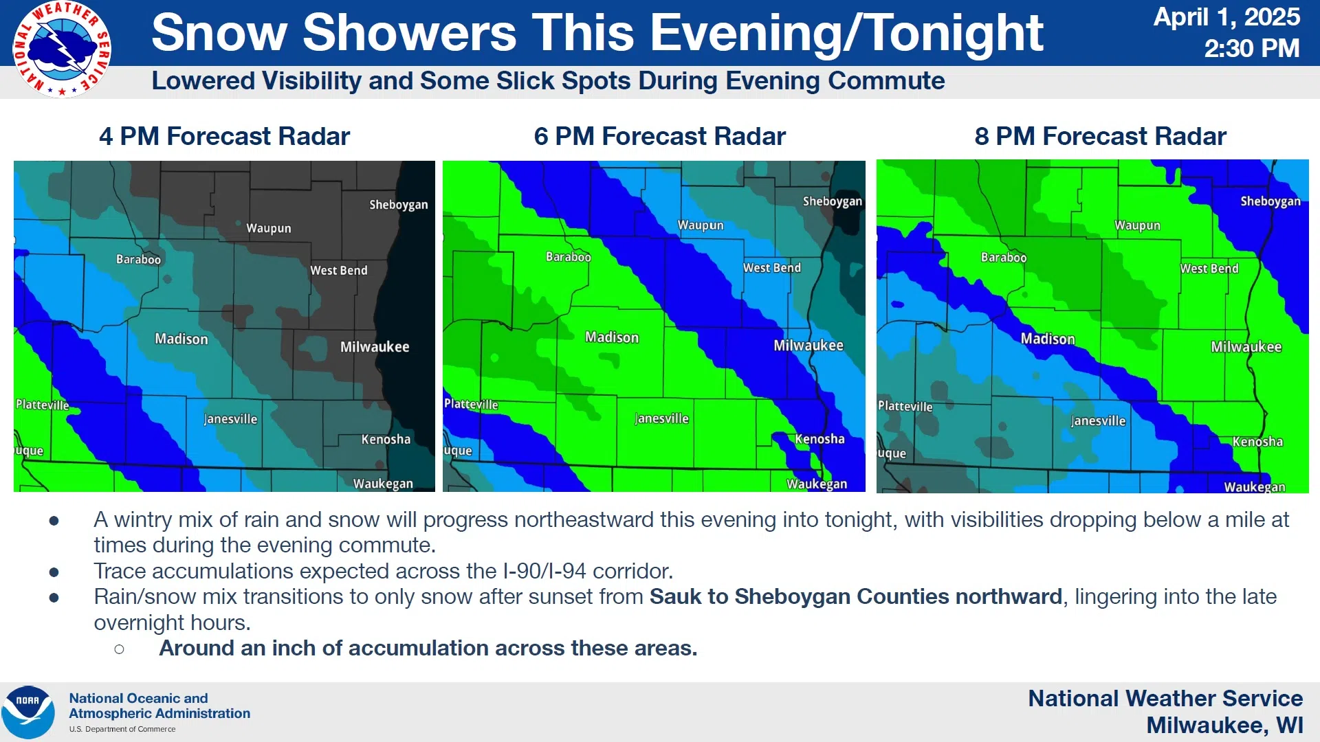
April 1st may be doing its own prank via Mother Nature, as several seasons get in on the joke. A slushy, wintry mix will progress across southern Wisconsin from southwest to northeast, reaching Sheboygan County between 6 and 8 p.m. Roads could get slick in spots, but the most likely areas to show accumulation will be grassy areas and raised surfaces. Still, the National Weather Service isn’t ruling out visibility problems in the heavier showers this evening. There should be no need for cleanup in the morning, as a transition to all rain is expected after 1 a.m.

NWS Graphic
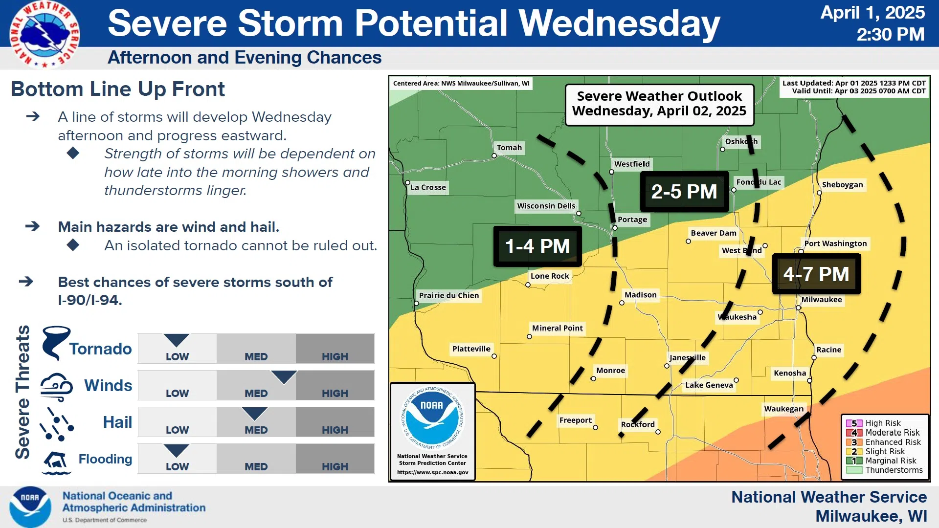
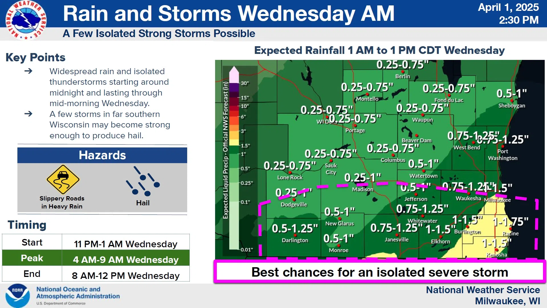
On Wednesday, springlike conditions return with thunderstorms making their entrance, especially in far southern Wisconsin where some large hail could be generated between 4 and 9 a.m. Wednesday. However, the greatest threat exists between 1 and 7 p.m. Wednesday in the form of damaging winds and large hail. For the most part, though, the area of concern focuses along and south of the I-90/I-94 corridor. If there is uncertainty, it centers around when rain ends Wednesday morning. Clearing skies would increase the likelihood of potentially severe storms.

NWS Graphic
With the drought solved and soils saturated, there could be standing water developing in spots, as around an inch, to an inch-and-a-quarter of rain is forecast before all is said and done.

NWS Graphic
The rest of the week looks cool and dry, with rain again possible by Saturday.


Comments