By winter standards, the storm passing through now through midday Thursday is garden-variety, but with Spring arriving just after 4 a.m. Thursday, the results will be an insult to those hoping that more springlike weather would make it all the more official.
NWS Graphic
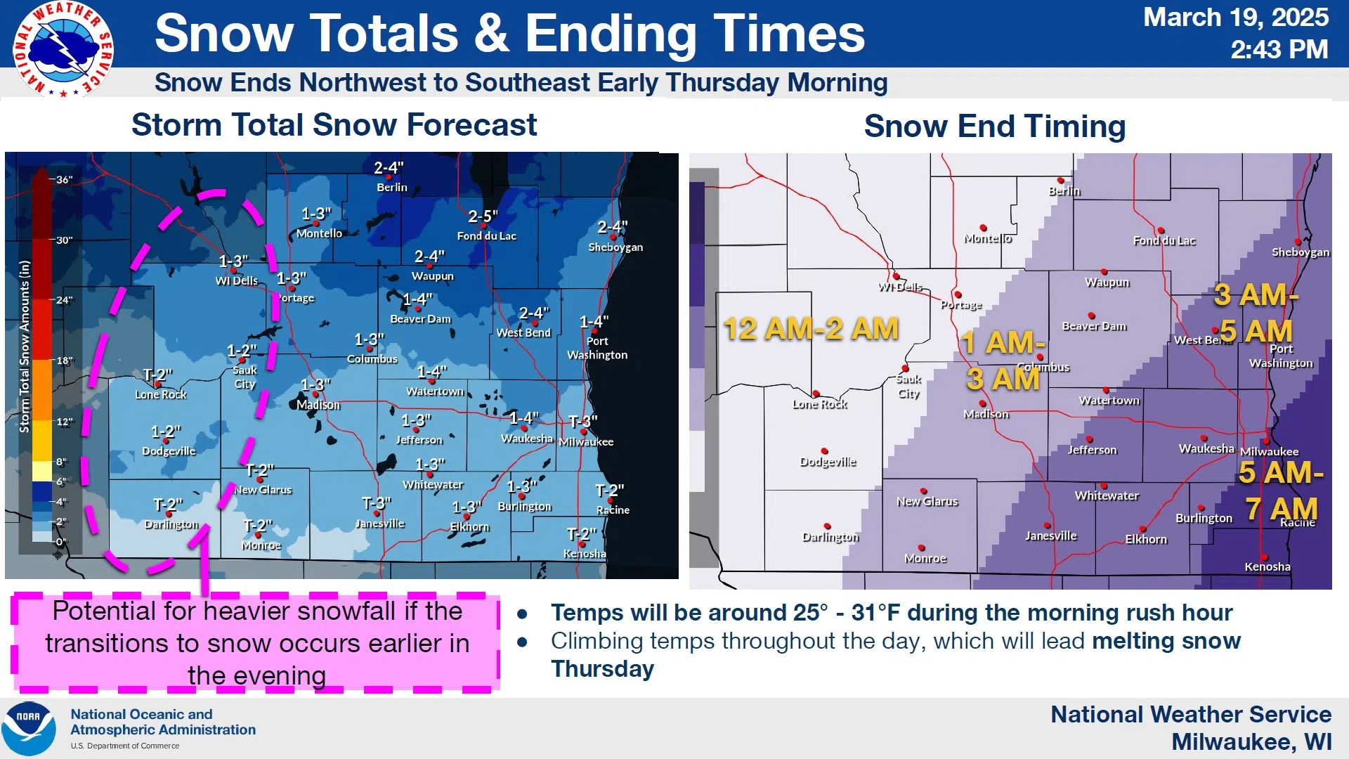
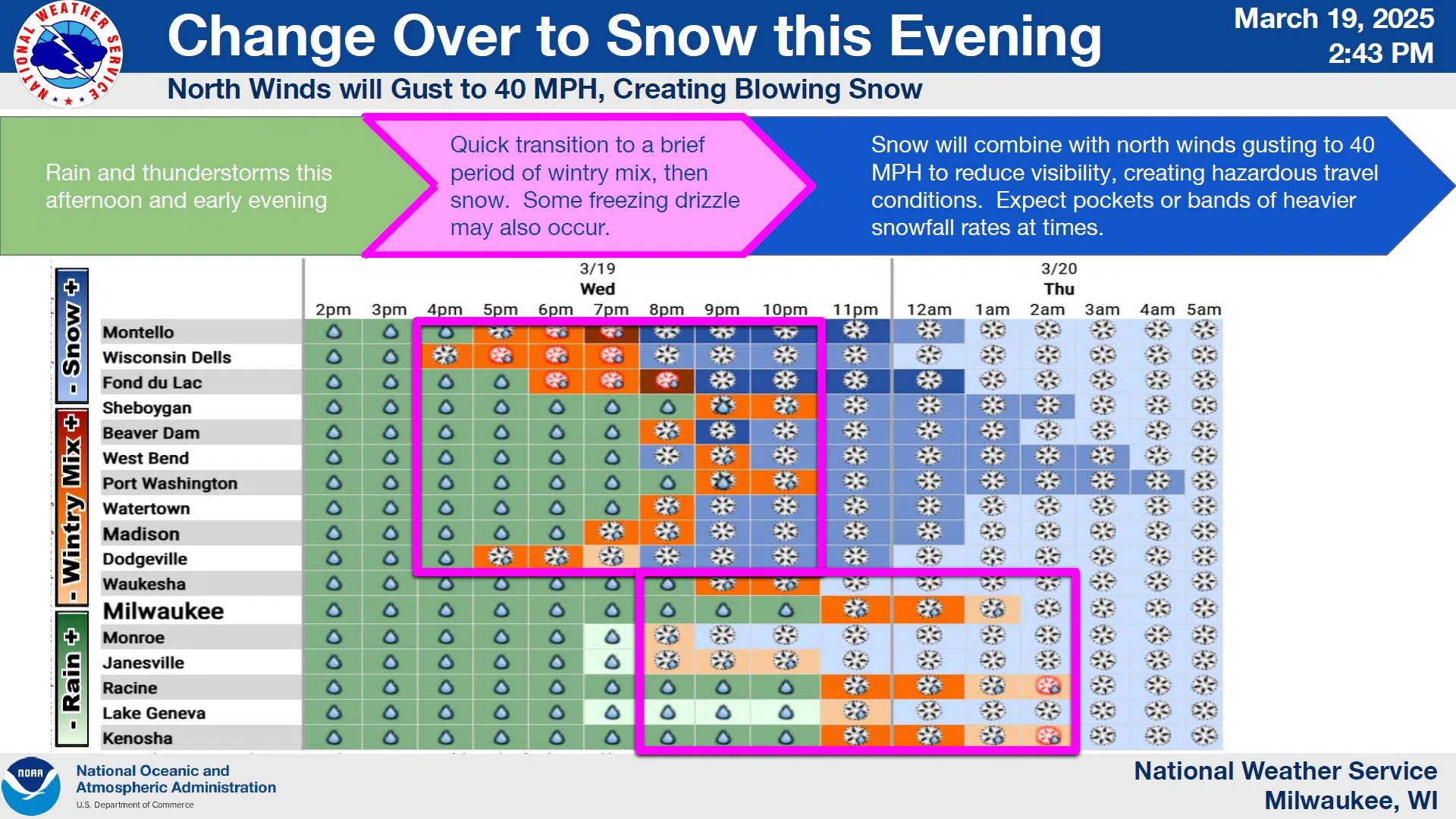
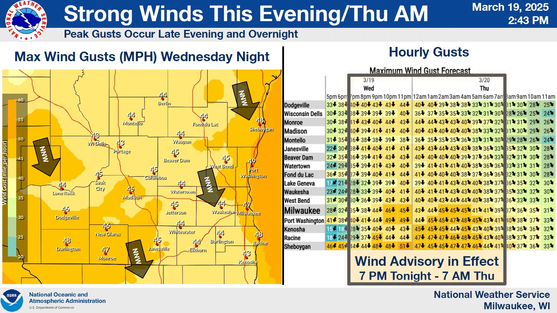
Forecasters have noticed a southward shift compared to earlier expectations, meaning the proximity of the heaviest snow band will be pushed closer to us from the north. Instead of the 1-2” forecast this morning, it now appears that 2-4” may be more likely to greet people waking up tomorrow morning. As the wet weather of Wednesday transitions to snow, probably around 9 p.m., things could get slippery as a mix of rain, sleet and snow heralds the arrival of the frozen precipitation. As temperatures slip below freezing near or shortly after midnight, some glazing of exposed surfaces could occur, and accordingly, a Winter Weather Advisory is in effect from 7 p.m. Wednesday until 7 a.m. Thursday. That coincides precisely with a Wind Advisory for sustained northerlies of 15-25 mph with gusts up to 45 mph. Combined with falling snow, visibilities could be significantly limited at times, holding the road could be a challenge especially in high-profile vehicles, while the threat of damage to utilities, trees and structures will also be present.
NWS Graphic
Snow should end by 7 a.m. Thursday with gradual clearing after mid morning. While winds should subside below advisory levels, gusts could still exceed 40 mph until afternoon, with a welcome period of winds under 10 mph for most of the night, returning to breezy levels on Friday.


Comments