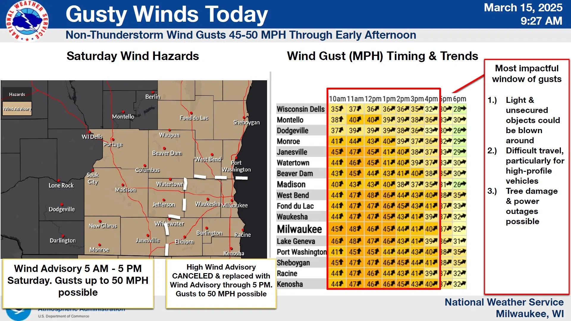
Windy is the word of the day, even as winds made news overnight in southern Wisconsin. The Sheboygan area escaped the severe storms that spent their energy over the south-central and southeastern counties, with straight-line winds downing numerous trees, and even sheds blown down in Jefferson County. A bit closer to home, several fences were downed between Beaver Dam and Horicon in Dodge County according to National Weather Service reports.
Winds here gusted to near 40 mph around 2 a.m. and rainfall was a scant .04”, and so the main event here will be the 20-25 mph sustained winds, which come with an advisory until 5 p.m. for gusts up to 45-50 mph. Debris from those severe storms could be picked up again where they struck, while here in Sheboygan County the threat is that of downed trees and power lines, and high-profile vehicles will be challenged on the roads. Temperatures will remain unusually mild for this time of year, rising to the mid-upper 50s.
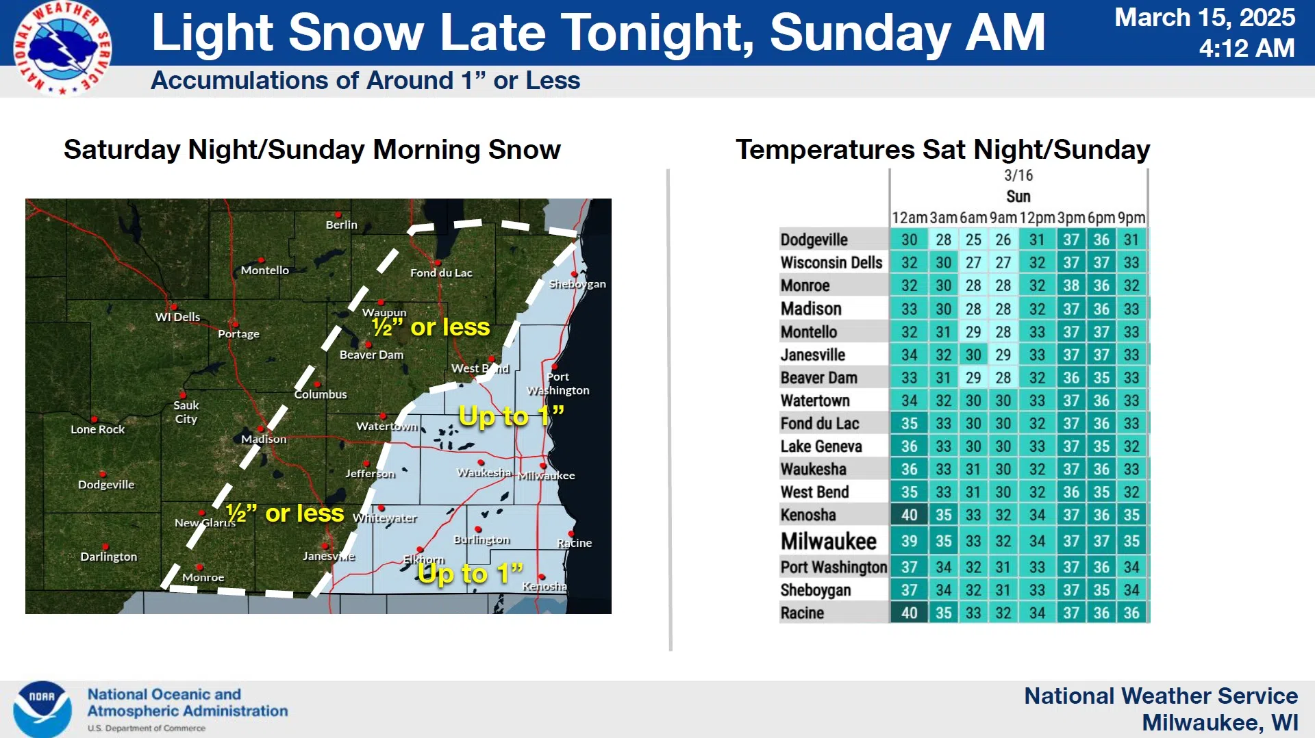
………………..Round Two – Light Snow……………..
NWS Graphic
Attention will then be given to the result of plunging temps overnight that will favor a round of light snow, mostly on elevated and grassy surfaces as lows dip below freezing. Less than an inch is anticipated overall, although some may see up to an inch, and rising temperatures and increasing sunshine Sunday afternoon should make short work of any accumulation.


Comments