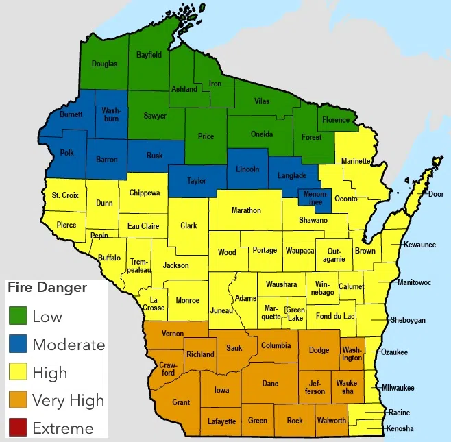
Attention will be given on several hazard fronts today as a strong storm affects us and much of the nation’s midsection. Those concerns begin with the dry, windy conditions today that have elevated the fire danger to a high level in most of central Wisconsin including Sheboygan County. Those levels rise to very high westward of a Washington County to Illinois line.
Attention then turns to the threat of severe thunderstorm weather overnight when many will be asleep, and forecasters advise having alerts activated on their cellphones in order to receive any warnings that might be issued.
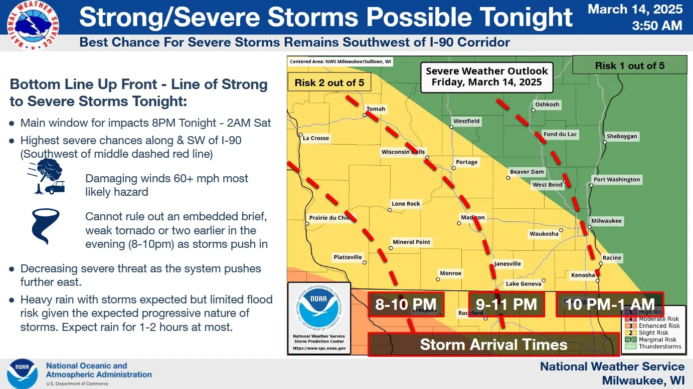
NWS Graphic
Storms will be strongest as they enter southwest Wisconsin around 8 p.m., and weaken as they progress northeastward, reaching the Sheboygan area after 10 p.m. The greatest risk for us will be straight-line winds that could gust over 60 mph in the strongest storms – if they maintain enough strength. Any storms should exit by 5 a.m., although the chance of light rain showers will linger the rest of the day.
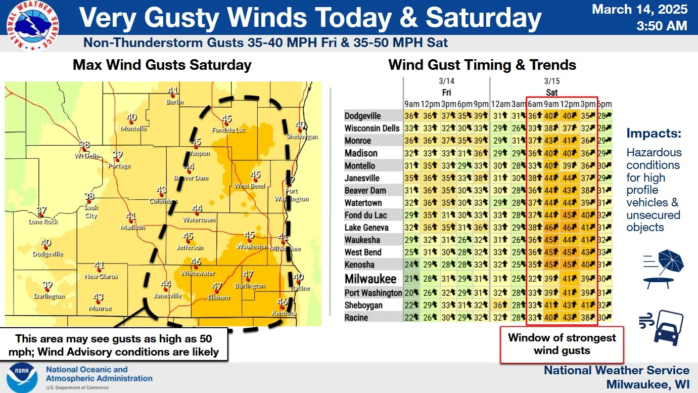
NWS Graphic
Behind the storms on Saturday, strong winds gusting over 40 mph may require a high wind warning, and will serve to maintain fire danger as well. That being said, temperatures won’t be bad for this time of the year today, reaching the mid 50s near the lake, while reaching the 70s inland. But by tomorrow a declining temperature trend will lead to a colder Sunday as snow showers again appear in the forecast.


Comments