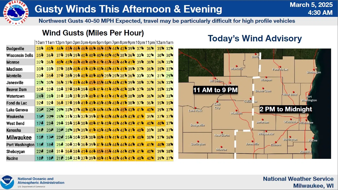
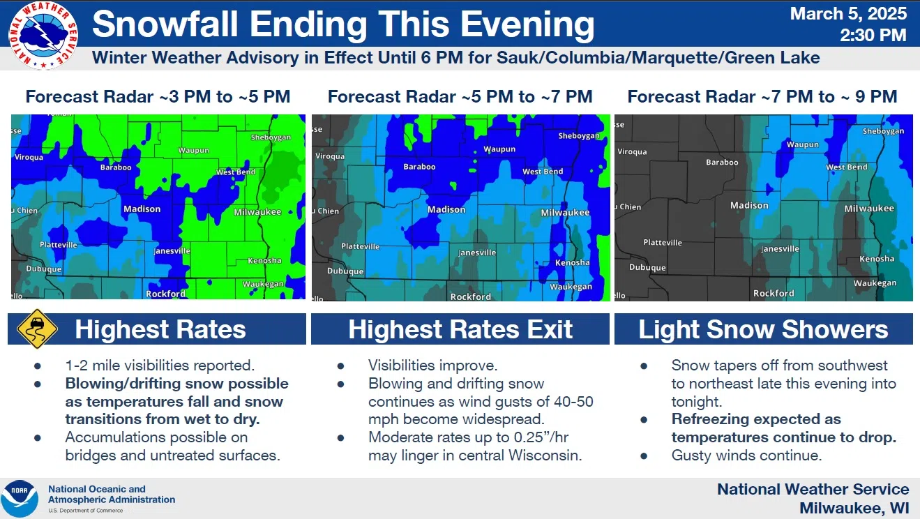
A late winter…or early spring?…storm mostly sprayed a cold rain upon Sheboygan County for the first half of Wednesday, with wet snowflakes gradually taking over with falling temperatures in the second act. The worst of the winter effects were felt far to the north, especially the UP. Winds were the only reportable hazard in our area, with an advisory for northwest winds sustained at 20-30 mph and gusting to 45, in effect until midnight tonight.
NWS Graphic
With less than an inch of snow potential remaining, all but the bluster should be done by then, with improving conditions the rest of the week. Projecting ahead, those improvements could send high temperatures all the way into the mid 50s by Tuesday.


Comments