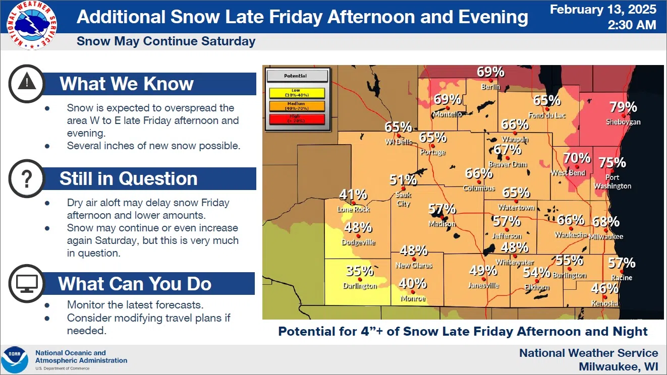
While the half-foot of snow initially predicted failed to materialize around here on Wednesday, snow lovers should be encouraged by the forecast for another round of winter weather arriving on Friday.
The next system is expected to move in from the west late tomorrow afternoon or evening, but uncertainty exists as far as exact arrival times due to abundant dry air. As of now, something in the neighborhood of 4 inches or more is anticipated over much of southeastern Wisconsin with the best odds of topping that measure occurring right here in the east-central part of the state. Forecasters assign a 79% chance that amounts will exceed 4 inches by Saturday morning.
There’s an additional chance that more snow will move in on Saturday once the overnight round moves out.
For now, Sheboygan County is in line to receive as much as 4-6 inches of snow Friday night, with the potential for another 1-2 inches from the second round on Saturday. A cold, mostly dry Sunday is then expected with temperatures in the teens, but wind chills in the single digits below zero.


Comments