As a winter storm now moving through the area does what these storms do – alter their form; sometimes slightly, sometimes frighteningly – the current system is behaving much as anticipated, and forecasters are holding to previous predictions on snowfall.
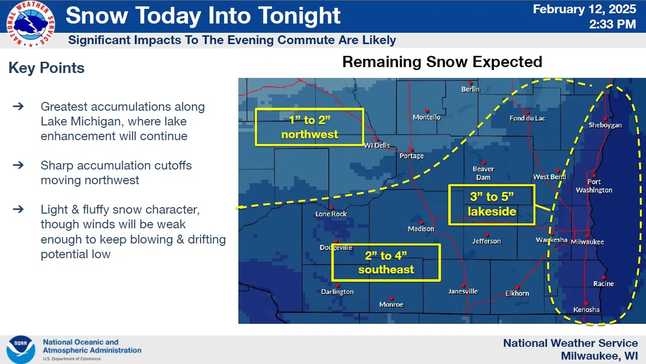
Rates have been heaviest near Lake Michigan, as is expected to be the case going forward, with an additional 3-5 inch accumulation expected within Sheboygan County, along with most of the warned area near the lake in southeastern Wisconsin. Inland areas can expect the lowest accumulations.
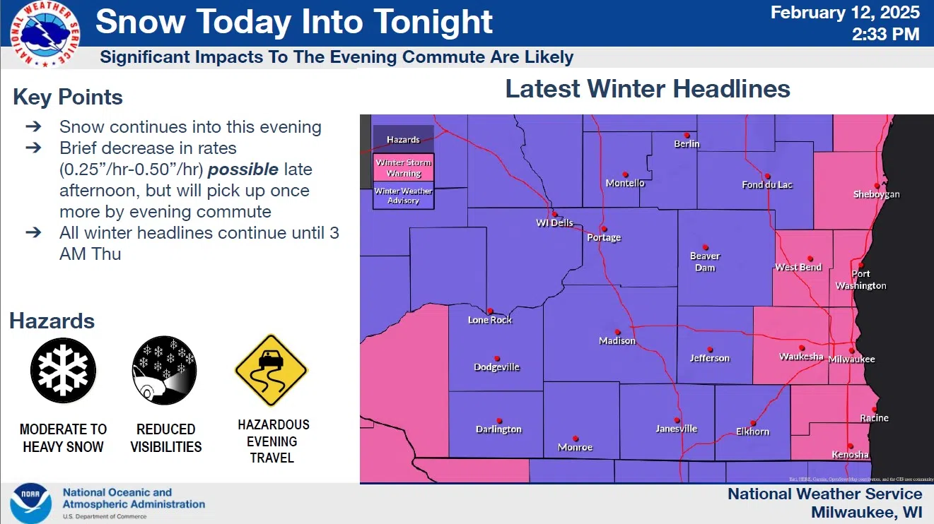
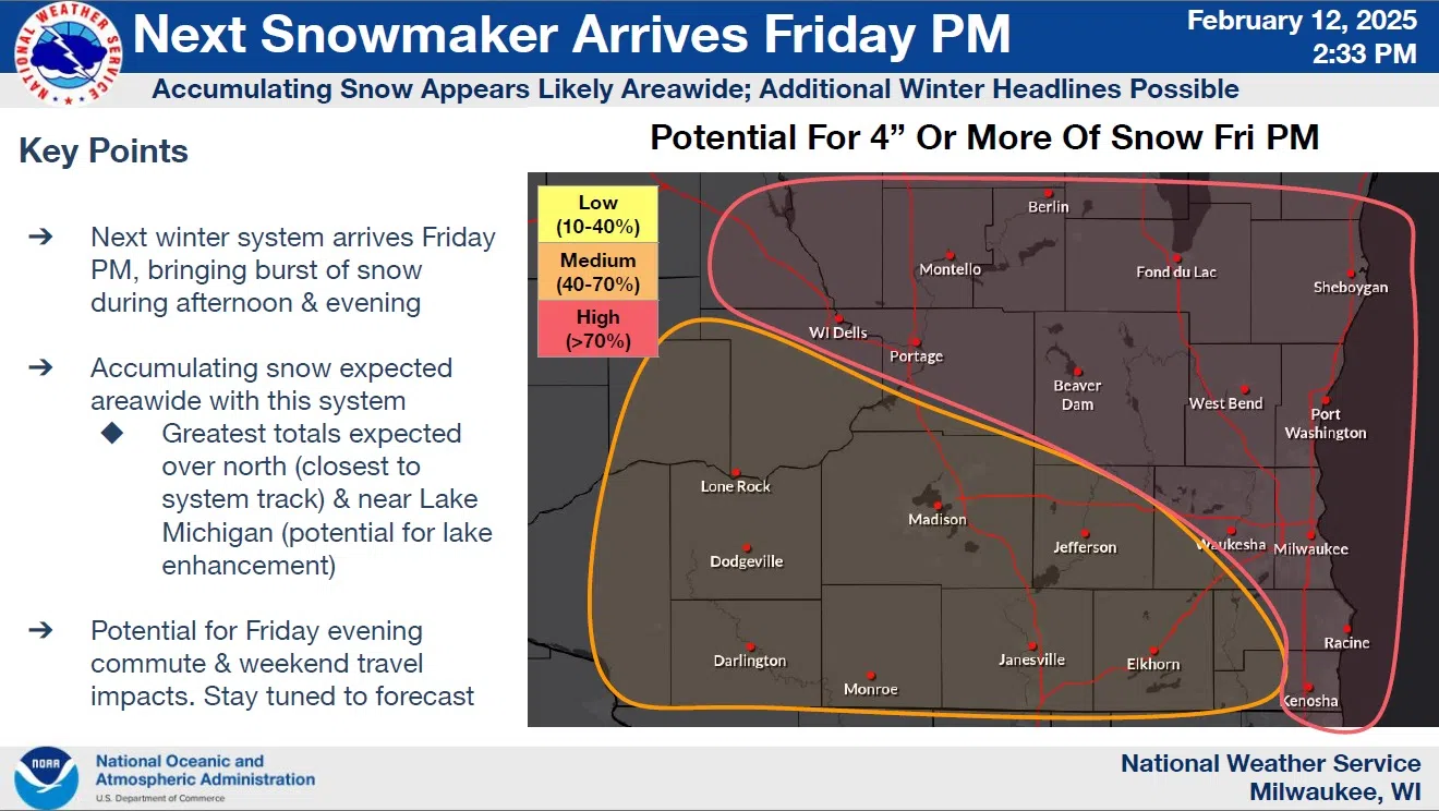
NWS Graphic
The National Weather Service acknowledged a lull in activity this afternoon, but advised that they expect things to pick up again during the evening commute. Due to the expected snowfall a Winter Storm Warning remains in effect until 3 a.m. Thursday.
Thursday itself is expected to offer quiet, cold weather for cleanup and preparation in advance of the next expected system, one that could potentially put down another half foot or so of snow beginning Friday afternoon.
NWS Graphic


Comments