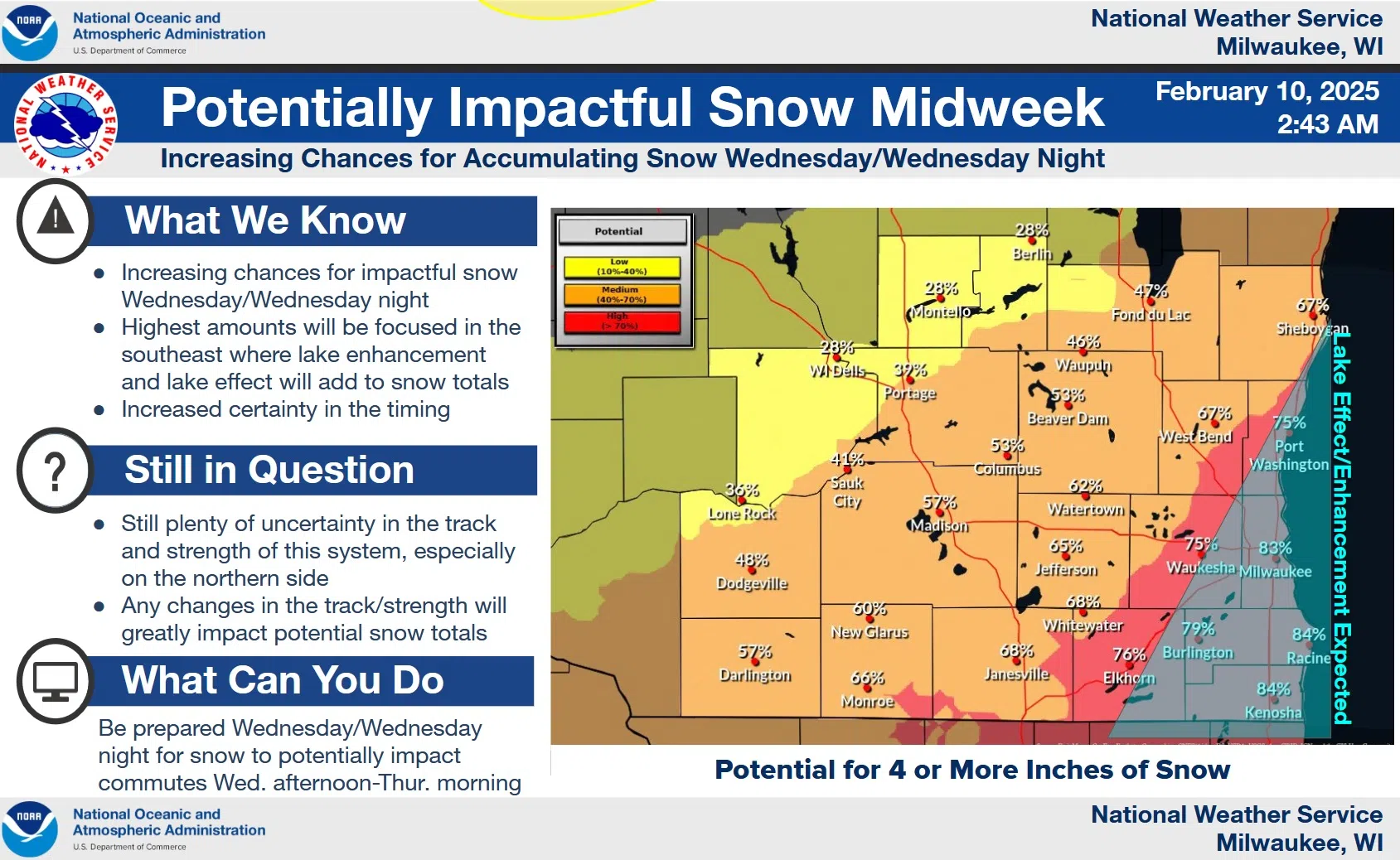
Winter hasn’t been short on snow storms – they just haven’t been frequenting most of our neighborhood recently, excepting the 5” that fell near Manitowoc County over the weekend. Despite many previous, failed predictions, snow lovers elsewhere in the county might get their wishes fulfilled beginning with Wednesday afternoon. Before that, though, we may get another dusting-to-one-inch overnight in a quick-hitting burst with only minor impacts.
Wednesday should start OK, but by midday a prolonged snow event is expected to be underway that could put down anywhere from 4-6 inches by Thursday morning – give or take a bit – across Sheboygan County. The highest potentials are likely from near Oostburg and Cedar Grove in the Southeast to Sheboygan where lake enhancement could produce more than a half-foot, while lighter totals are more likely to the northwest near Elkhart Lake.
Those are potentials, and not predictions, and with plenty of uncertainty, forecasters aren’t ready to go on record with amounts quite yet. While potentials are high, moisture is not, and a leaf blower might do as well as a snow blower on the lighter amounts. And even with moderate, 10-15 mph winds, the light nature should make for visibility and travel problems into Thursday morning, and the public is being advised to keep up with the forecasts.


Comments