Mild weather has made an impression so far this winter, even though January actually came in a bit colder than usual. However, the lack of snow allowed for warm spells that would otherwise have had a hard time succeeding. February’s first days look to buck that trend.
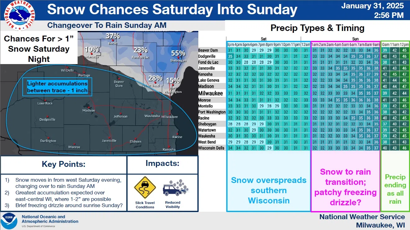
After record highs in the mid-50s on Thursday, and still mild, but more seasonable temps on Friday, Saturday is likely to remain below freezing, with snow beginning after 9 p.m. That snow could mix with rain after 3 a.m. Sunday with around an inch of wet accumulation possible by sunup. Any snow on the ground should be gone by nightfall as sunny skies set in around noon and temperatures reach into the mid-40s by mid afternoon. Temperatures more typical of this time of year should hold sway after that, with highs remaining near freezing, and nighttime lows in the teens and 20s most of next week.
The snow Saturday night could cause some slick roadways, and patchy freezing drizzle Sunday morning could make things even more hazardous. But the chance for large-scale problems seems minimal for now.


Comments