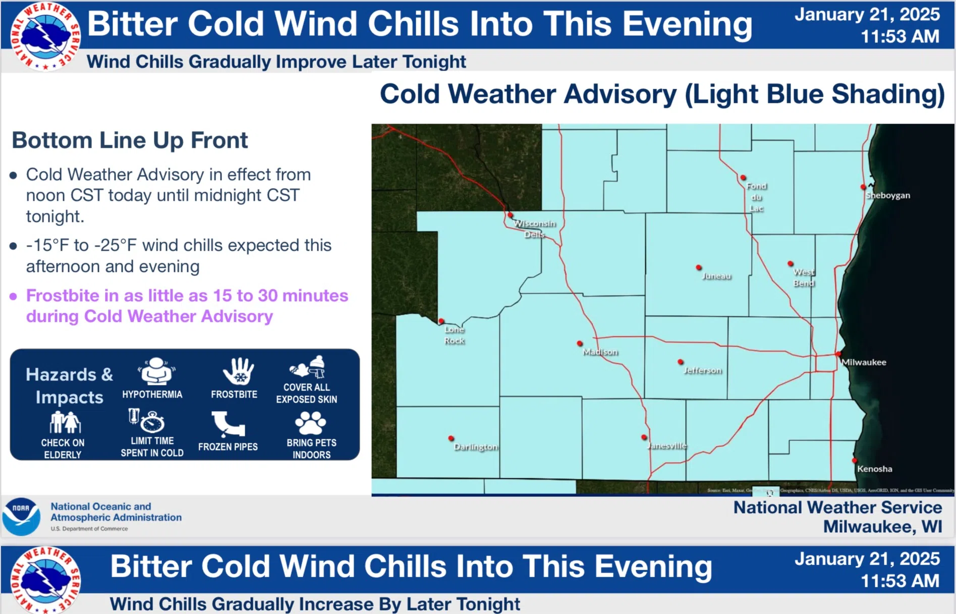
After a morning that featured wind chills reaching 30 below with an actual low temperature of 11 below, conditions have “improved” as temperatures eked an advance to -4 by noon. Wind Chills were still a hazardous -22, but that leaves the “Extreme Cold Warning” category behind and a “Cold Weather Advisory” takes its place until midnight.
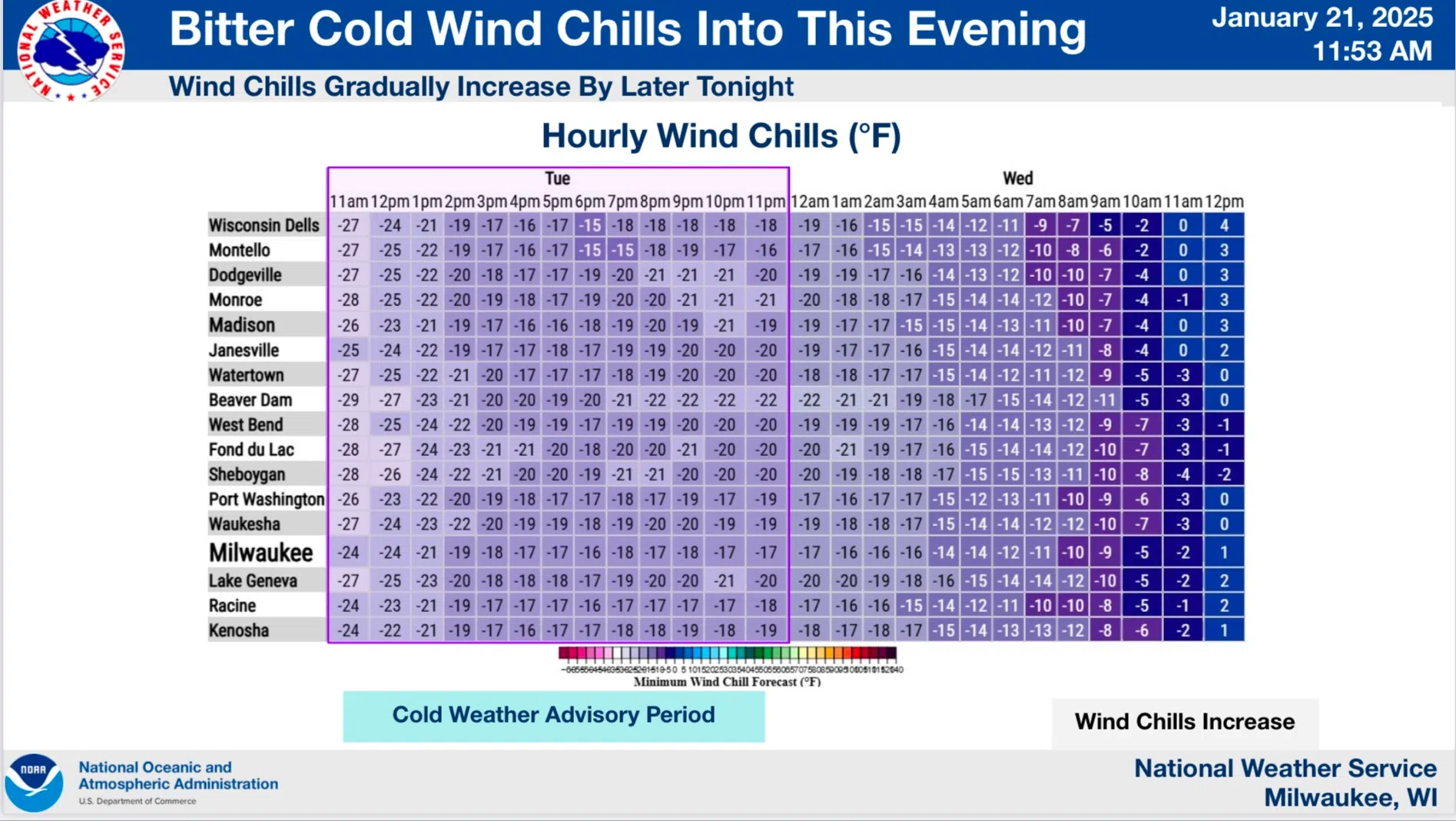
Bitterly cold temperatures and wind chills will still be in control despite abundant sunshine, and with the passage of a warm front tonight, improvement should continue and no further advisories for the cruel temperatures should be needed.
NWS Graphic
That improvement does come with the risk of around an inch of very light, fluffy snow by the time for work and school in the morning, but advisories for that aren’t anticipated either.


Comments