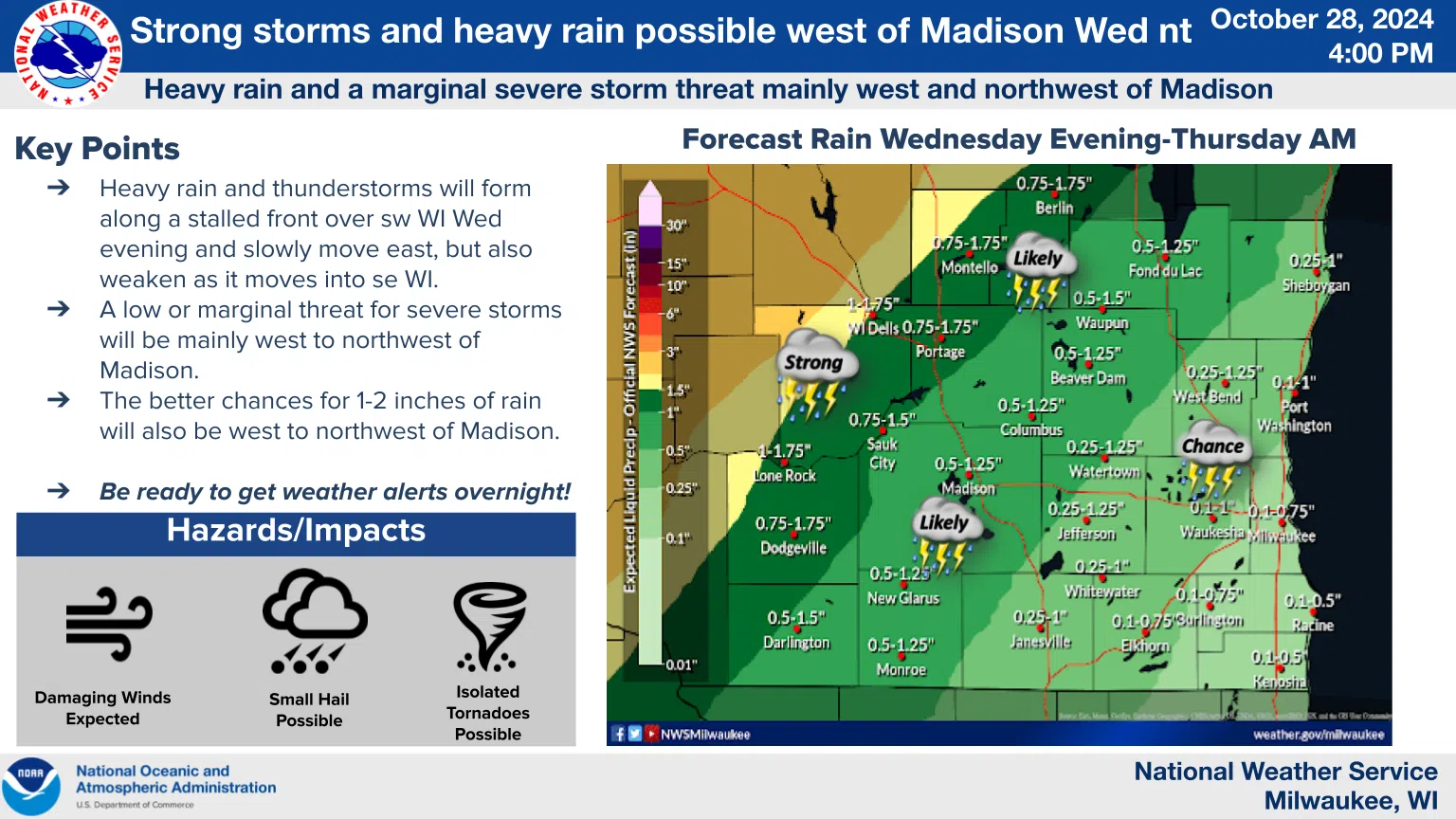
After issuing Monday-afternoon warnings of possible severe weather for Wednesday night, the National Weather Service is giving a bit of a reprieve to southeastern Wisconsin and the Sheboygan area.
Forecasters are still watching for heavy rains and thunderstorms to form along a stalled front over southwest Wisconsin tomorrow evening, weakening as they move slowly our way. However, it now appears that a low-to-marginal threat for severe storms will be in areas mainly to the west and northwest of Madison. In southeastern Wisconsin, though, the risk of severe weather is less, given the weakening trend and overnight timing.
Rainfall, which is still sorely needed here to make progress against a moderate drought, should provide some relief when it begins around 4 p.m. Amounts of between one-quarter and one-inch are expected, with possibly heavier totals in the northwest portion of Sheboygan County. And until then, unusually warm, windy weather will provide what is likely the last taste of summer for 2024.


Comments