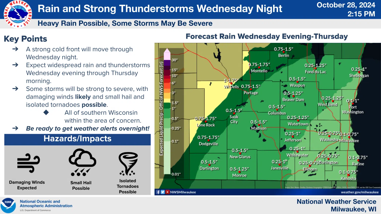
In an unusually early “heads-up” move, the National Weather Service is advising everyone in southern Wisconsin to prepare for severe weather from Wednesday evening through Thursday morning. The culprit – or culprits – behind the severe potential will be an influx of summer-like moisture, combined with a potent cold front passing through the state on Wednesday night. Ingredients are favorable enough that the National Weather Service warned on Monday afternoon that a widespread outbreak of rain and thunderstorms is expected ahead of that front beginning Wednesday evening, adding that some storms will be strong to severe, with damaging winds likely, and small hail and isolated tornadoes possible.
There are both “up” and “down” sides to the forecast; up, in that much-needed, and widespread rains of between one-half and one inch are expected, with some rain gauges reading up to 2 inches by the time storms exit on Thursday morning. Specifically for Sheboygan County, between one-quarter and one-inch of rain is forecast, with the heaviest amounts towards the northwest. The down side, though, is that the rain comes at the peak of the autumn leaf-drop, driven on winds…absent of thunderstorms…gusting to over 30 miles an hour on both Tuesday and Wednesday. That enhances the risk of blocked drains due to collected leaves, leading to ponding of water on roadways.
The National Weather Service is advising the public to be weather-ready, especially overnight Wednesday into Thursday.

smile.ginger / Depositphotos.com


Comments